Commissioned by the Metropolitan Park Commission of Providence in 1904, this two-and-a-half mile scenic, tree-lined parkway was devised by Olmsted Brothers to offer drivers panoramic views of the Providence River, Narragansett Bay, the bustling industrial harbor of East Providence, and scenic woodlands. Although eligible for historic designation, the site remains unprotected and at risk of losing its distinctive character, connectivity, and viewsheds as new developments drastically alter the waterfront.
History
Rhode Island gained its first public park in 1746, when deputy governor Daniel Abbott set aside a public square adjacent to Providence’s Congregational Church, in emulation of Massachusetts’ theocratically organized towns and cities. At the turn of the twentieth century, Providence looked to Boston, hoping to replicate the work of their Metropolitan Park Commission, and in particular the idea of the Emerald Necklace, designed by Frederick Law Olmsted, Sr., with Charles Eliot and John Charles Olmsted, beginning in 1878 to link parks, greenways, and waterways. The Metropolitan Park Commission of Providence was formally established in 1904 and immediately set about raising funds to create a ring of parks and scenic reservations connected by a spoke-like formation of parkways.
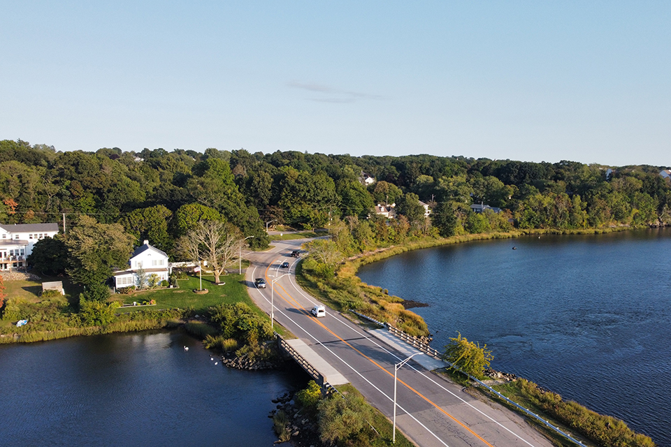
A popular component of the Commission’s plan was Barrington Parkway, a scenic pleasure drive designed to offer connectivity between green spaces while also providing uninterrupted east and west views, protected by park-like reservations of land on either side. The Olmsted firm had originally proposed the parkway extend from Mauran Avenue to Nayatt Avenue in Barrington, but the Commission ended the parkway project at Pawtucket Avenue, for a total length of two-and-a-half miles. The Olmsted Brothers firm was engaged as “expert advisor,” charged with advancing the Commission’s goal to conserve the “picturesquely wild” character of the land, eschewing ornamentation that would distort the natural setting.
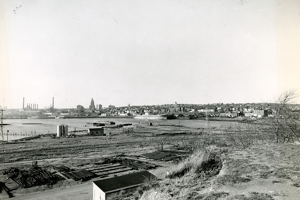 Fort Hill with view of Providence River and City of Providence, 1958. Photo courtesy of Rhode Island Collection, Providence Public Library.
Under the leadership of Frederick Law Olmsted, Jr., firm employees including Percy Reginald Jones consulted on the project through the early 1920s, developing a total of 245 plans for the project. An initial design was proposed in 1906, and planning for the 116-acre parkway began in 1910. By that year, the Commission had purchased parcels of land across East Providence, eventually acquiring much of the property around Fort Hill, which offered a panoramic view of the Providence River and Narragansett Bay, with the active upper harbor in the foreground providing “at all times a scene of extraordinary interest.” At the north end of the drive, along the bluff of Fort Hill, the firm proposed adding a pedestrian promenade adjacent to the road, with a path leading to an overlook sheltered by a gazebo, though ultimately only a grove of oak, pine, and maple trees and a commemorative marker were installed at the overlook, alongside a vehicular turn-off.
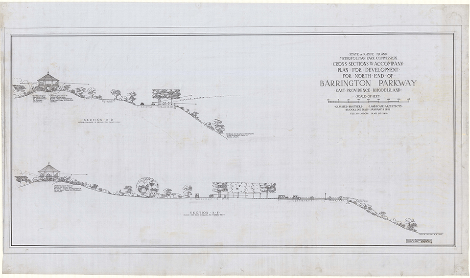 Plan for Development of North End of Barrington Parkway, 1921. Photo courtesy of Frederick Law Olmsted National Historic Site.
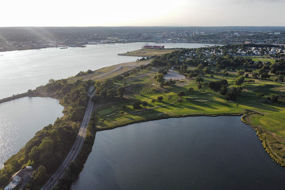
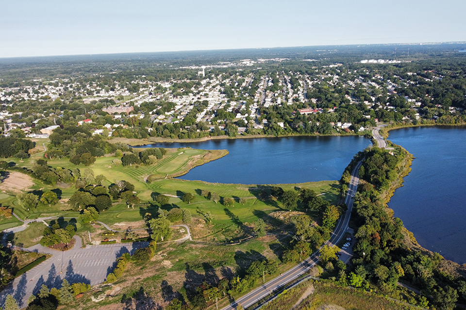
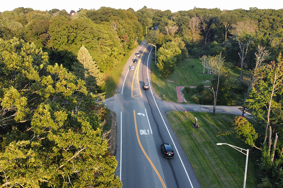
Moving north-to-south through East Providence, the winding parkway lined with Norway maples is laid out to pass several scenic features, including the Metacomet Golf Club (1919) to the east and sand fields once dotted by oil tanks to the west. Though not strictly Picturesque in character, the oil tanks were kept in full view, believed by Olmsted Brothers to highlight the industrial heritage of the city. In its middle segment the drive crosses Watchemoket Cove and the 28-acre native Squantum Woods to the west, developed as a roadside scenic reservation by the Works Progress Administration in the 1930s.
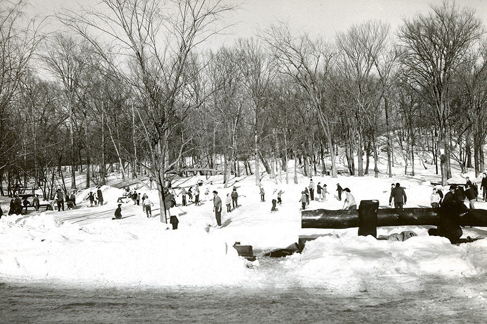 A small frozen pond surrounded by trees and snow, as seen from the parkway, 1961. Photo courtesy of Providence Public Library.
The Olmsted plan included several strategically placed triangular medians at intervals throughout the drive, planted with small trees including hawthorns, red cedars, and laurel-leaved willows. At least seven medians remain extant, though a tree survey would be required to determine what remains of the Olmsted firm’s plantings. Following World War II, Barrington Parkway was renamed Veterans Memorial Parkway. In 1991, the parkway was designated by the Rhode Island Department of Transportation as a Scenic Roadway.
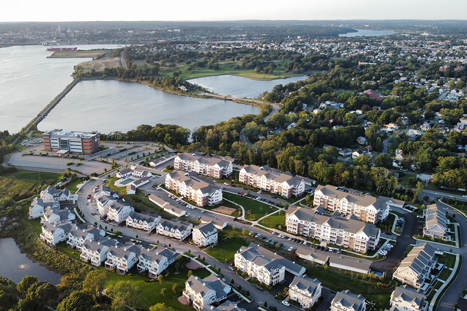
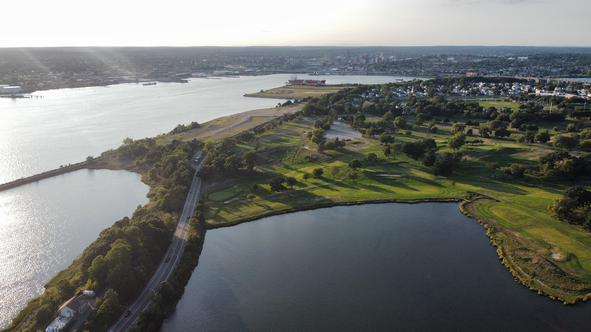
Photo by Dereck Mendoza.
Threat
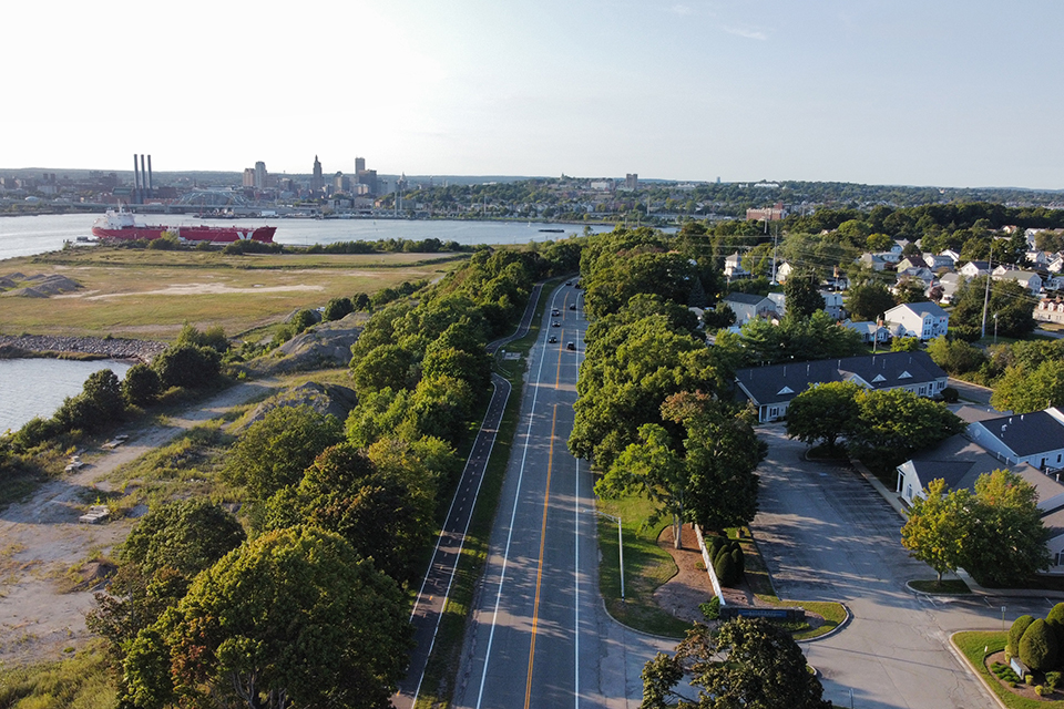
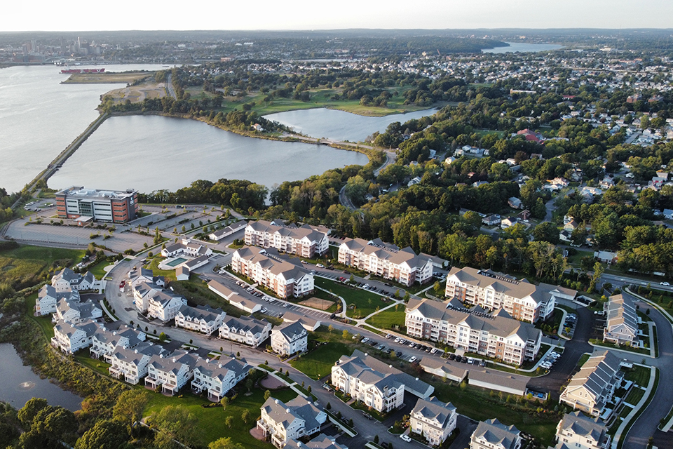
Today the winding drive continues uninterrupted. There are no stop signs, roundabouts, or traffic lights; the parkway runs through a scenographic landscape experience of residential streets featuring an eclectic mix of turn-of-the-century architectural styles, suburban housing tracts, scenic reservations, former industrial and commercial zones, and new residential and mixed-use developments. The East Bay Bike Path, built between 1987 and 1992, occupies a former railroad right-of-way for fourteen miles from Providence to Bristol, running through the Olmsted firm-designed road verge alongside Veterans Memorial Parkway for much of its route through East Providence. The East Providence Waterfront Commission (EPWC), established by the state legislature in 2003, has further transformed the area surrounding Veterans Memorial Parkway into a development-focused district with new housing and commercial centers.
The former industrial area at the parkway’s mid-section, known as Kettle Point, was first sold for mixed use development in the 1980s. In 2015, the land was sold to developer Richard Baccari and a 49-acre residential and commercial district was constructed on the site through 2021, with limited community involvement in the planning process. The buildings composing the 290-unit residential and commercial complex at Kettle Point, along with a nearby medical center, are all four or five stories in height, privatizing the scenic drive’s views. In 2020, the more than hundred-year-old Metacomet Golf Club was also sold for development. Bolstered by the waterfront district’s designation as a qualified opportunity zone in 2018, the EPWC has ambitions to extensively redevelop the area to the east and west of Veterans Memorial Parkway, destroying the original design intent that afforded drivers with a scenic foreground to carefully-framed midground and distant borrowed views. To accommodate an increase in density and traffic, geometric, modern roundabouts have also been proposed, which would further alter the character of the Olmsted Brothers’ historic corridor. The results: a generic transportation solution that will have an adverse effect on the parkway, resulting in a more conventional roadway – one that takes the “pleasure” out of the Pleasure Drive.
Of additional concern are the multiple in situ archaeological sites located along the parkway, dating to the Late Archaic and Woodland periods, when the Pokanoket (previously referred to as Wampanoag) native peoples populated the area. While most of the area surrounding the bay had been developed by the twentieth century, locations along the parkway remain some of the only sections of land viable for the protection or excavation of undisturbed materials.
Although a nomination for listing in the National Register of Historic Places, outlining the parkway’s eligibility under two criteria, was completed and approved by the Rhode Island Historical Preservation & Heritage Commission in 1991, the nomination was never submitted to the National Park Service by the state, despite public support. Without designation or a determination of eligibility, in this Olmsted-designed parkway remains under threat of imminent commercial development without a review under the Section 106 process, which requires federal agencies or applicants seeking federal funds, permits, or licenses to consider the effects of their undertaking on properties listed in or eligible to be listed in the National Register of Historic Places.
What You Can Do to Help
Write to the Rhode Island Historic Preservation Office and the East Providence Historical Society to advocate for the National Register of Historic Places nomination for Veterans’ Memorial Parkway to be completed and moved forward.
Jeff Emidy, Interim Executive Director, RI State Historical Preservation & Heritage Commission Officer
P: (401) 222-4134
East Providence Historical Society
65 Hunt’s Mills Road
Rumford, RI 02916
Write to the East Providence Waterfront District Commission and Rhode Island Department of Environmental Management to emphasize the importance of protecting this Olmsted-designed parkway and surrounding landscape, as well as the borrowed views it offers to all, as the waterfront develops.
Ray Lavey, Executive Director, East Providence Waterfront District Commission Terrence Gray, DEM Director
P: (401) 222-2771 ext. 277241
-
Photo by Dereck Mendoza.