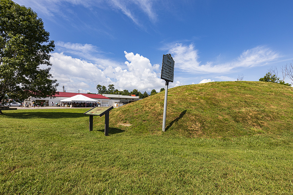
Built nearly 1,000 years ago, the Nikwasi Mound once anchored an agrarian community and formed part of an important network of Cherokee towns along the Little Tennessee River. The Nikwasi Mound has witnessed centuries of history and withstood numerous attempts at erasure, but remains a vital part of the Eastern Band of Cherokee Indians' spiritual and cultural life .
History
Built some 1,000 years ago, the Nikwasi Mound in western North Carolina remains a spiritual, cultural, and ceremonial center for the Eastern Band of Cherokee Indians. Once the center of a 100-acre agrarian community, the Nikwasi Mound has witnessed centuries of history and withstood numerous attempts at erasure.
 Kituwah Mound Historic Site. Photo courtesy Polly's Granddaughter – TCB.
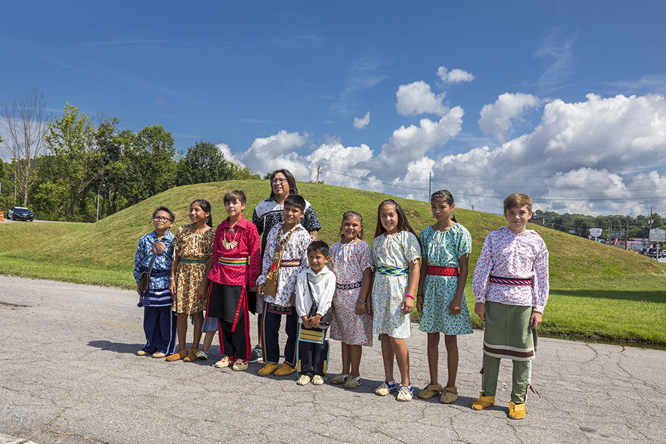
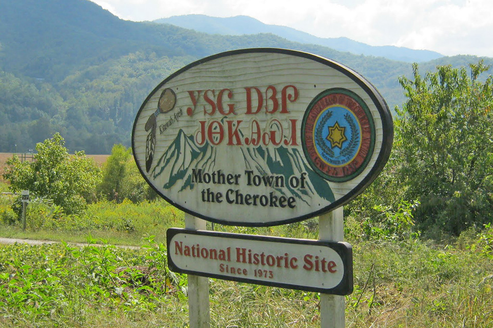
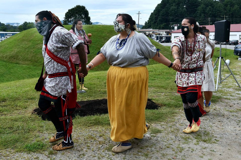
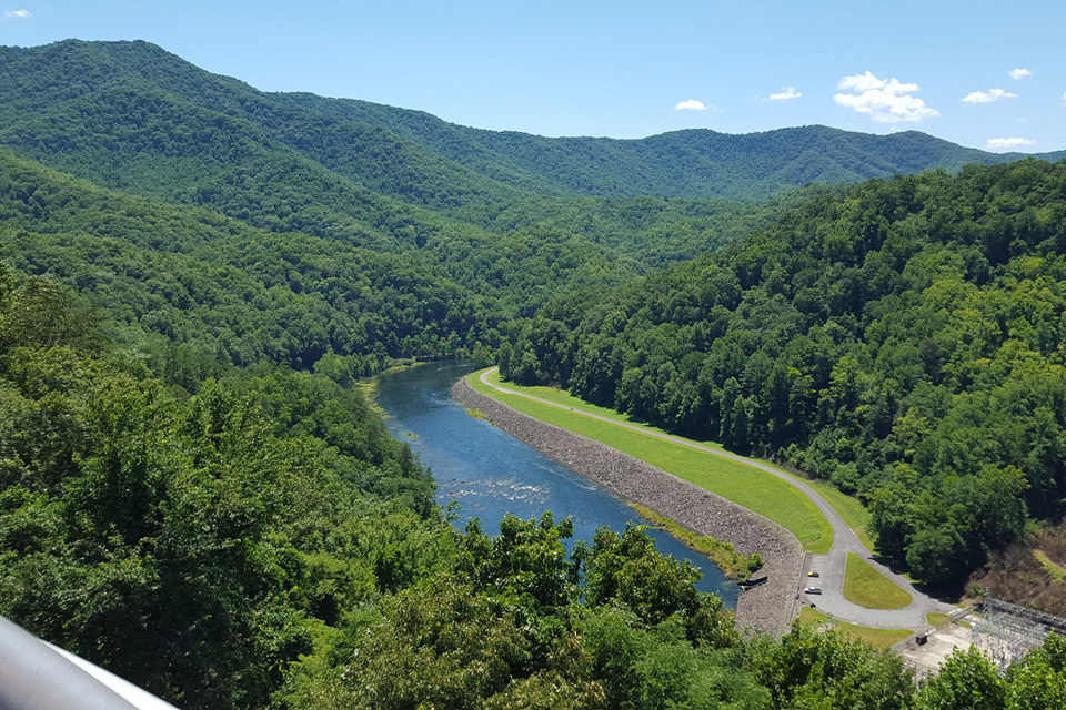
Nikwasi and the nearby town of Kituwah are considered Cherokee “mother towns,” communities where Cherokee people have been living since time immemorial. Cherokee elders recount oral traditions associating the Cherokee origin story to Nikwasi (which means “star place”), known as the home of the Nunne’hi, immortal warriors who protect the Cherokee in times of war. Both Nikwasi and Kituwah appear in expedition accounts by Spanish explorer Juan Pardo dating as far back as 1566, signifying their established significance in that period. The mounds at Nikwasi and Kituwah, like other Cherokee mounds, supported council houses which housed central hearth fires, kept burning at all times to support the practical and spiritual daily needs of the community. Located along the Little Tennessee River, Nikwasi is linked by the river and its tributaries to several other Cherokee towns within the mountains of western North Carolina and north Georgia, known as the Middle Towns. These communities, each with a central, prominent platform mound, formed an important political and economic network that prospered for centuries. The river was an important thoroughfare and a vital spiritual center where the Cherokee townspeople performed the ceremony of “going to water,” a ritual bath taken before important events.
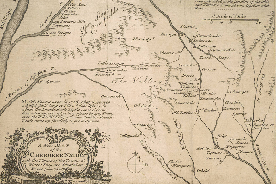 Map of Cherokee Territory, 1760. Photo courtesy Library of Congress.
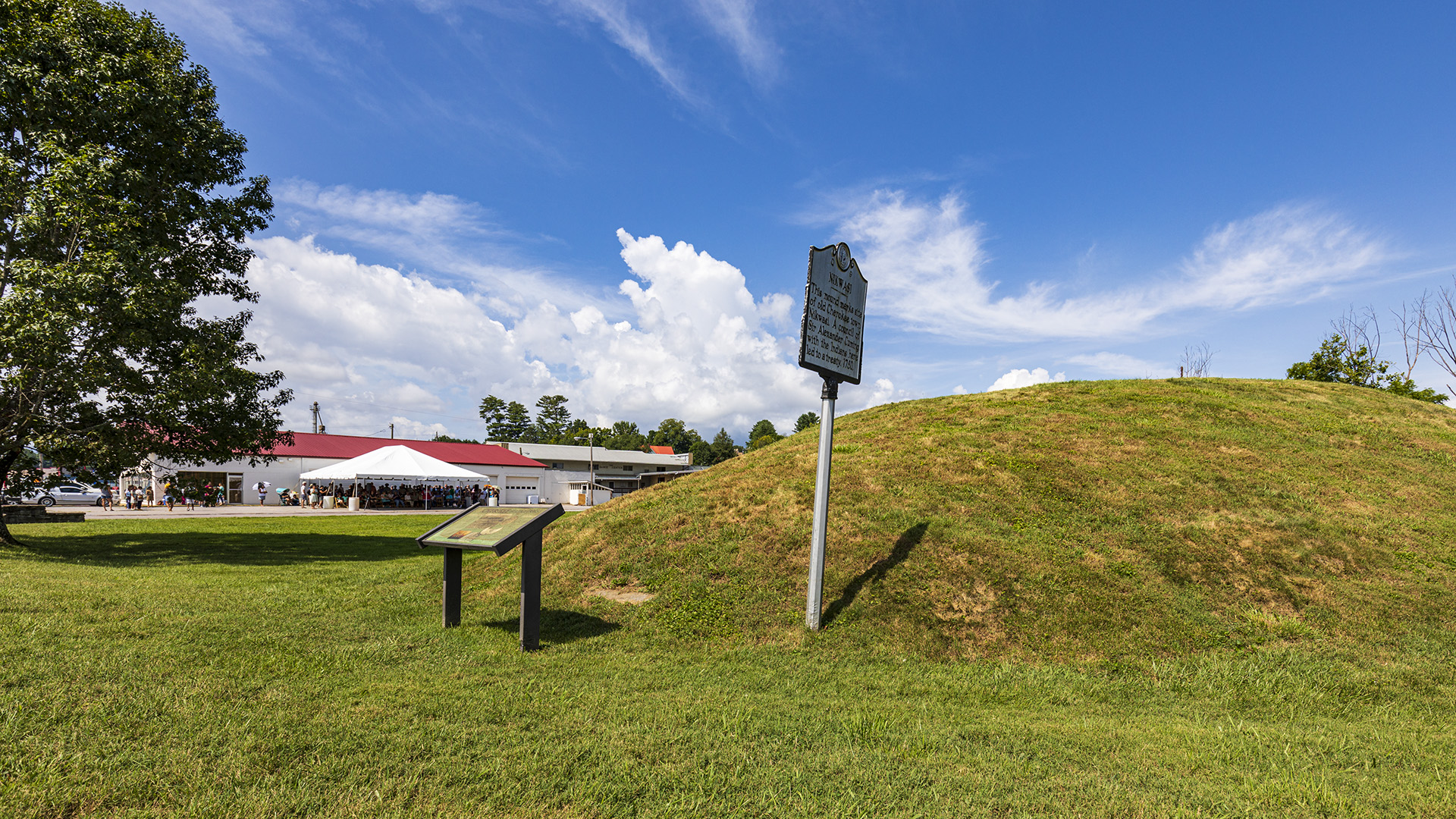
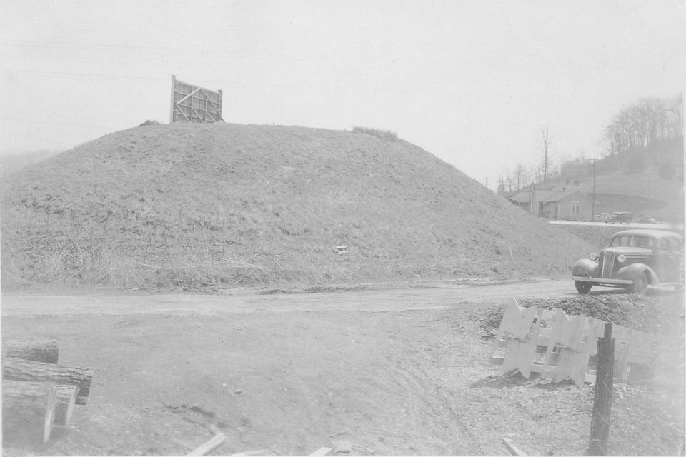
Mounds built in what archaeologists call the Mississippian period, from roughly 1000 to 1700 A.D., share some physical characteristics, including size and orientation. A 1937 survey of the mound at Nikwasi measured its dimensions as 30 meters wide and 50 meters long, rising to a height of six meters. Celestial and solar alignments and proximity to the river defined the organization of this cultural landscape. The mound’s promontory offered connection to water, land, and sky: a view of the Little Tennessee River valley, the surrounding mountain peaks, and the smoke rising from hearth fires in townhouses atop mounds in communities beyond.
In the eighteenth century, European colonists swept through Cherokee towns committing extraordinary violence and seizures of land. During the French and Indian War of 1761, the area surrounding Nikwasi was razed, and the council house appropriated by English aggressors for use as a field hospital. The Nikwasi Mound survived, only to be occupied again in 1776 by General Griffith Rutherford and his troops, who used it as a staging area for attacks on the surrounding Middle and Valley Cherokee communities.
Despite repeated attacks, Nikwasi remained in Cherokee control until the early nineteenth century. In 1819, a Cherokee woman called Rebecca, the sister of the esteemed warrior and leader Junaluska, claimed a parcel of land which included the mound under Article 2 of the 1819 Treaty of Washington. This allowed those Cherokee people “believed to be persons of industry, and capable of managing their property with discretion” to claim and reside permanently within a 640-acre tract. Shortly after this treaty was ratified, however, the North Carolina General Assembly ordered all recently acquired lands to be sold. Rebecca, and her husband Gideon Morris, fought extensively in court to keep their land, but eventually were granted a cash payment in lieu of their reservation. In 1821, the mound was purchased by a wealthy, white North Carolinian and was protected as a novelty greenspace for many decades. In the late nineteenth century, various attempts were made by antiquarians and archaeologists to excavate the mound, but permission was not granted by the Bureau of American Ethnography, and Nikwasi remains unopened, unlike most large mounds in western North Carolina.
 Nikwasi Mound photographed by National Park Service surveyor Hiram Wilburn, 1937. Photo courtesy Dr. Ben Steere.
Throughout the nineteenth and twentieth centuries, as the surrounding town of Franklin developed and took possession of the mound in public trust, the mound was preserved more as an artifact of an ancient, disappeared people with touristic appeal rather than as a living monument to an enduring culture. Concurrent with the planning and construction of the nearby Smoky Mountains National Park and the Blue Ridge Parkway, the town of Franklin viewed their mound as a unique attraction which distinguished them from other rural communities, hoping to capitalize on increasing regional tourism by appropriating Cherokee culture. A fanciful history of the mound’s origins and a mid-twentieth century fundraising campaign led by Franklin’s schoolchildren helped construct a narrative of the town’s benevolent care of it. This overshadowed persistent Cherokee claims to ownership of the mound. Many other intact mounds continue to be used by Cherokee people as community centers for events, recreation, ceremonies and rituals, and daily spiritual practices.
 Nikwasi Mound, 2020. Photo by John MacLean.
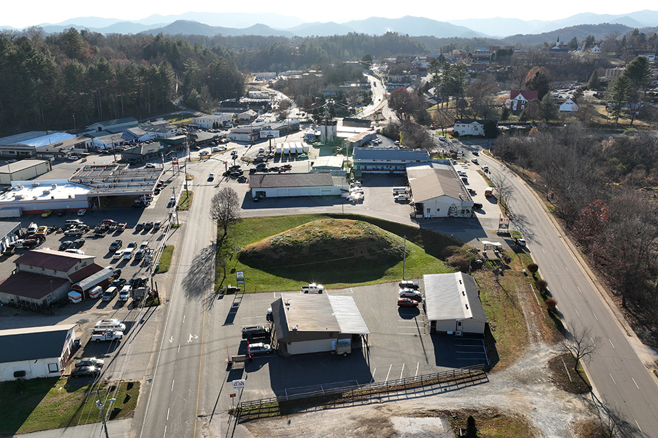
In the twentieth century, the land around the mound, close to the river and prone to flooding, was artificially elevated with several feet of fill dirt, drastically altering the topography of the landscape. In the twenty-first century, the mound has been subject to herbicide treatment and contamination from a nearby fuel oil leak.
Threat
Along with centuries of battles and occupation, the mound has also been affected by commercial encroachment, highway construction, and chemical application. To this day, there are some who would like to see the Mound destroyed to make room for commercial development or to relieve the city from the perceived burden of maintenance. Cars traversing the roads encircling the Mound generate noise pollution, interrupting the peaceful atmosphere around a site with great spiritual significance. While such a grounded landscape feature as a mound may seem permanent and immovable, the complicated history of Nikwasi Mound underscores the vulnerability of such sites and the ongoing, essential need for protection, education, and rejuvenated vitality.
The identity of the Cherokee people today is imminently threatened by a loss of Cherokee Language speakers and storytellers. Nikwasi Mound anchors that identity, giving it continuity and a memory. The mound provides a place for reflection in a bustling world, while surrounding densification threatens to disconnect the mound from its people and its potential in strengthening intercultural understanding. The increasing rumble of trucks and cars, and the development of businesses make reflective meditation at the site problematic.
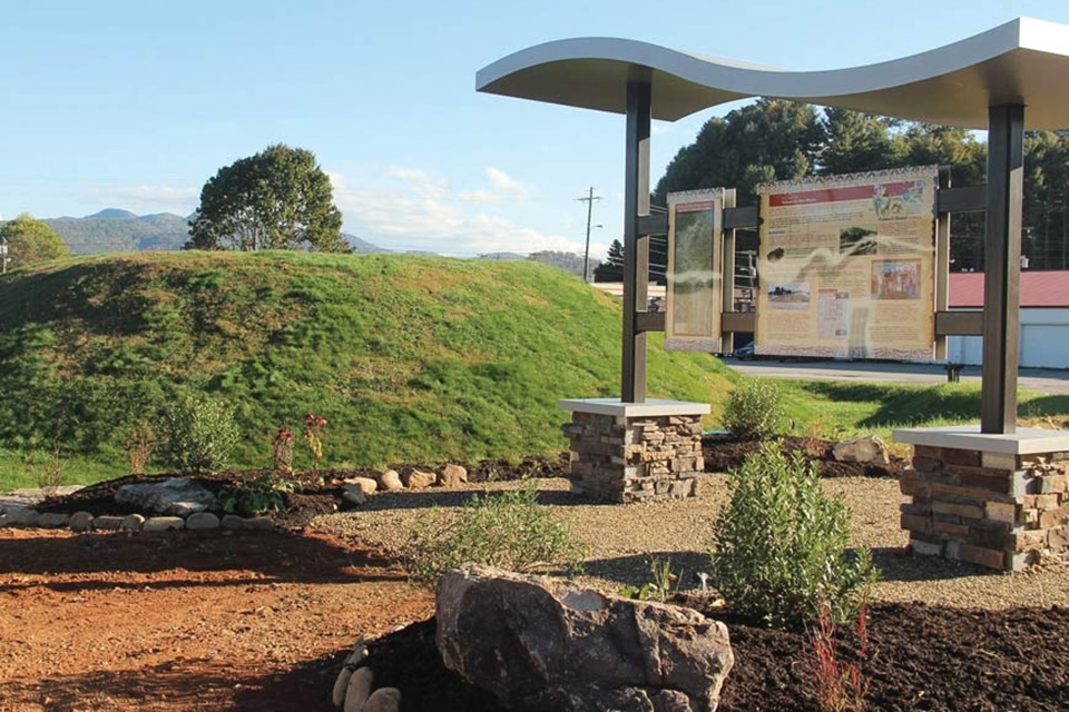
The Nikwasi Initiative, a partnership composed of members of the Eastern Band of Cherokee Indians, Franklin Town Council, Macon County officials, and Mainspring Conservancy, along with community heritage advocates, is working to restore the sense of community, agricultural self-sufficiency, and education that surrounded the original community of Nikwasi. The Nikwasi Initiative hopes to build a “Cultural Corridor” along a stretch of over 60 miles of the Little Tennessee River, linking the headwaters of the river and the historic Cherokee landmarks on its banks. The hurdles facing such a project are enormous and the costs significant. Perhaps the greatest threat is that of inaction, exposing this site to further encroachment by commerce and misguided efforts, leading to eventual deterioration and loss of its purpose and historical and cultural significance.

What You Can Do to Help
Write to North Carolina Governor Roy Cooper requesting state action to honor the site’s earliest residents and their descendants in connection with upcoming national and statewide celebrations marking the sestercentennial of America’s founding in 2026.
North Carolina Office of the Governor
20301 Mail Service Center, Raleigh, NC 27699-0301
Phone: (919) 814-2000
E: https://governor.nc.gov/contact/contact-governor-cooper
Donate to the Nikwasi Initiative to protect and promote the history and sustainability of the Nikwasi Mound and the surrounding cultural landscape. If you have a story to share about the history of the site or a personal or familial connection to it, contact the Nikwasi Initiative to have your story recorded.
Nikwasi Initiative
P.O. Box 2197, Franklin, NC 28744
Phone: (414) 286-2221
Elaine Eisenbraun, Executive Director
Phone: (828)226-7523
E: elaine@nikwasi-initiative.org
Visit the Cherokee cultural landscapes of the western North Carolina mountains, including the Nikwasi Mound. When visiting the Nikwasi Mound, be mindful to keep a respectful distance.
Nikwasi Mound
524 E. Main Street, Franklin, NC 28734
Learn More about the history of indigenous land seizure in your area and respect and amplify Native voices in conversations about preservation and land management.