Among New York’s several discrete neighborhoods settled by free Blacks in the pre-Civil War era was Sandy Ground, a community in Staten Island that dates to 1799. While a cemetery and a number of extant structures, including a few dozen homes and a church (which was a stop on the Underground Railroad), remain, continued development and under-recognition continue to threaten these remnants of an important layer of NYC’s history.
History
Beginning in the first quarter of the nineteenth century, Sandy Ground, located within the neighborhood of Rossville on the South Shore of Staten Island, was among the earliest communities for free Black Americans in New York City. It became one of several such discrete localities throughout the city in the pre-Civil War era, though most have since been eradicated. Another prominent example, Seneca Village, was razed to make way for the construction of Central Park; Weeksville, in Brooklyn, is perhaps the only other comparable example that remains to a similar extent today, with several retained houses from the early 1800s (protected under their designation as New York City Landmarks), and a dedicated Heritage Center to tell its story.
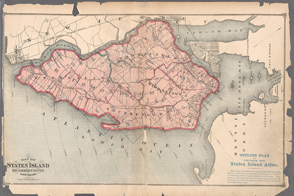 1874 map of Staten Island by F.W. Beers. Photo courtesy New York Public Library.
The name “Sandy Ground,” a reference to the soil type found in that part of Staten Island, is first noted in records dating to 1799. Composed of glacial sediment, the area was cultivated as farmland, and though the variably sandy, dry, and compacted clay soil was not ideal for many crops, the families who began to settle there discovered that several prospered, including strawberries.
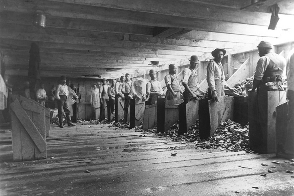
By the late 1820s, soon after slavery was abolished in New York State, several African American families had purchased plots of land in the area. The community began to grow by the 1840s, when a number of free Black families migrated north from Snowhill, Maryland, in the Chesapeake Bay area, seeking the relative freedoms that the northern states afforded. The move was largely motivated by the oyster trade: while restrictive segregation laws were imposed in Maryland, obstructing African American participation in the oyster business that they had played a major part in cultivating, they sought work elsewhere, finding it in the oyster-rich waters of Staten Island’s Prince’s and Raritan Bays. Notably, though Staten Island is located mere miles from Manhattan, there was only one means of travel between the two at the time—via the Lewis Columbia ferry, which was operated by John Jackson, one of the first Black landowners in the community.
 Staten Island oystermen, 1894. Photo by Alice Austen - courtesy Sandy Ground Historical Society.
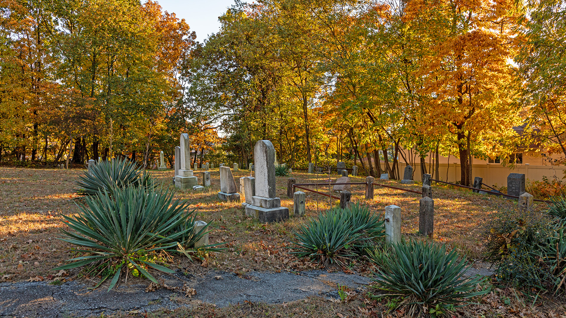
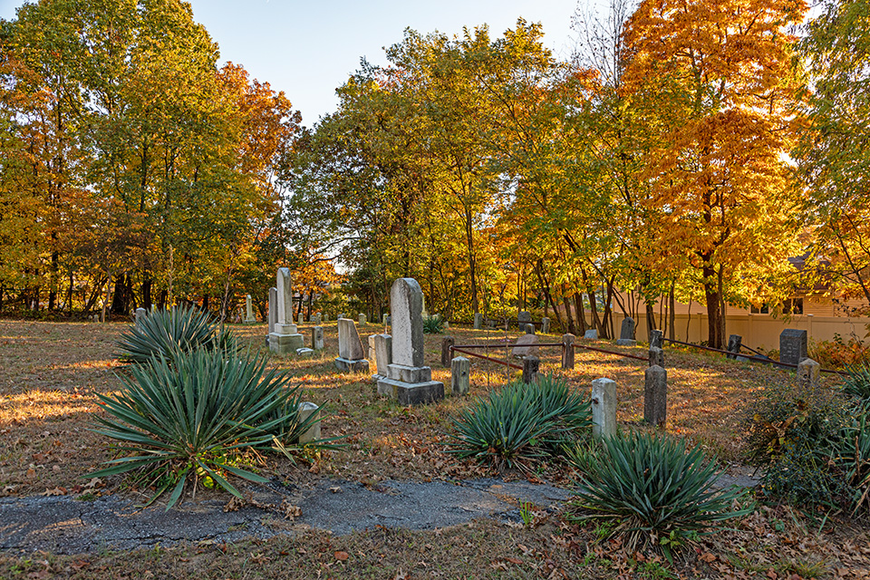
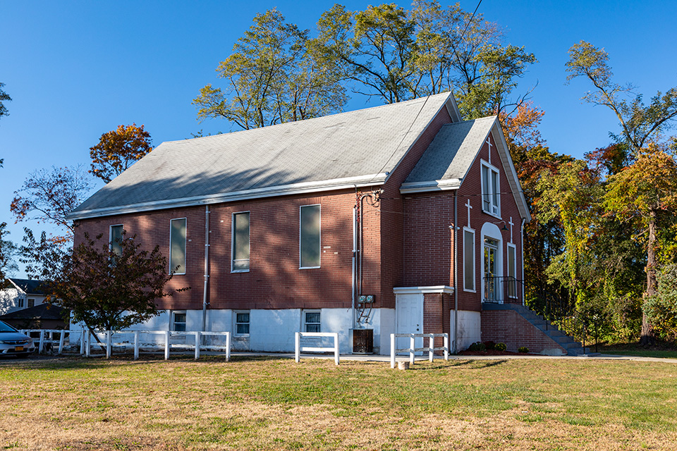
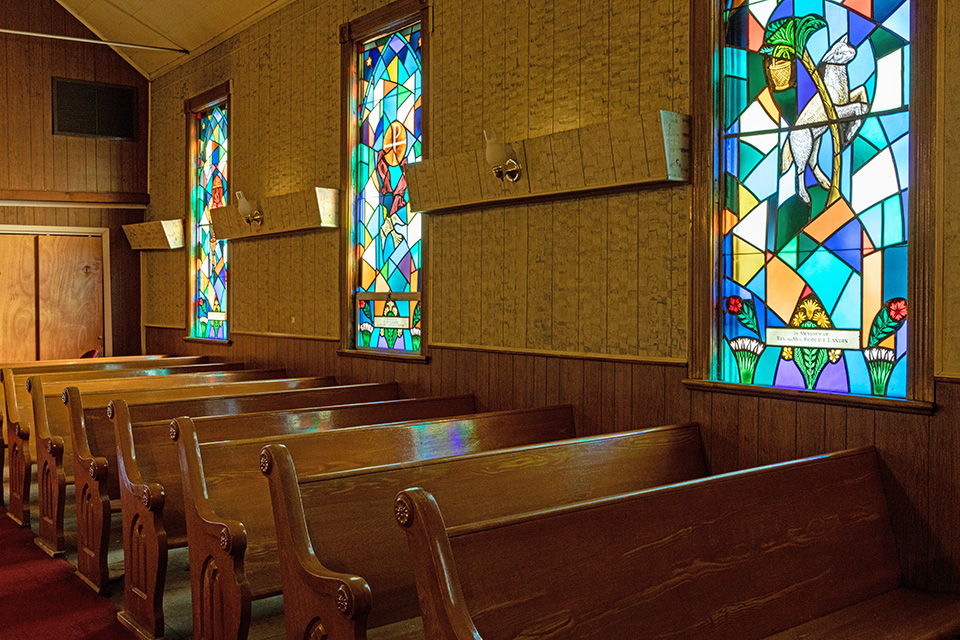
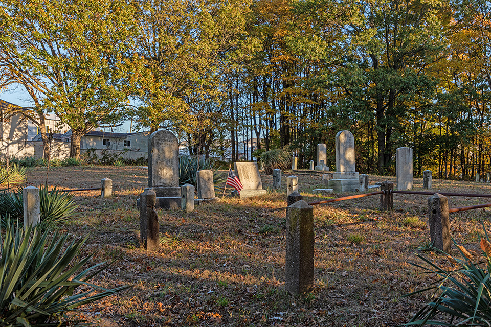
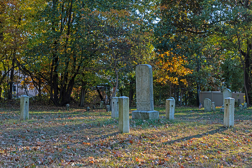
In the decades that followed, the neighborhood continued to flourish. At its height, Sandy Ground contained more than 150 Black-owned homes. As was typical of the free Black communities that developed during this time period, the church was an integral, and often literally central, asset to the community. The Rossville African Methodist Episcopal (AME) Zion Church was first established at Sandy Ground in 1850, relocated to a purpose-built place of worship in 1854, on Crabtree Avenue. The network of AME Zion Churches throughout the city had many renowned abolitionists among its congregants, including Harriet Tubman and Frederick Douglass; civil rights leader Reverend Thomas James called the Rossville congregation his own. In addition to serving its religious purpose, the church was a place for social gatherings, camp and school activities, and cultural events. By 1897, the congregation had outgrown its wooden structure, and a new church was built by local developer Andrew Abrams (the vernacular building was designated a New York City Landmark in 2011). The original church site, an important stop along the Underground Railroad, was demolished at some point in the first half of the twentieth century, though its cemetery, containing some 30 visible grave sites, hundreds of unmarked graves, and with a viewshed over the Wachtung Mountains of New Jersey, remains.
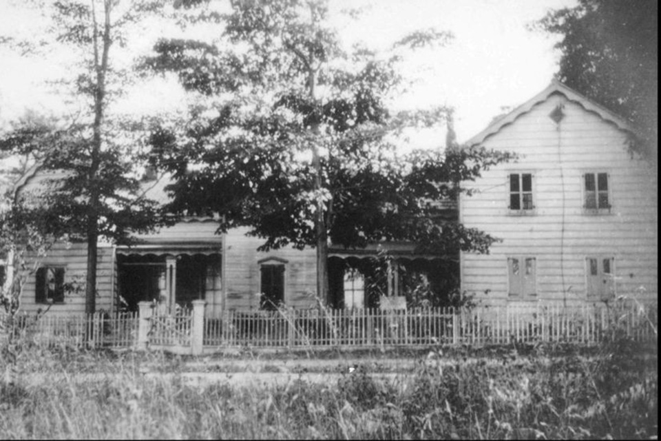 Boarding house in Sandy Ground, Staten Island, 1840s. Photo courtesy Sandy Ground Historical Society.
While several factors put a strain on Sandy Ground’s oyster industry by the turn of the century, particularly overfishing, and the pollution wrought by industrialization of the shoreline and nearby areas, it was a typhoid outbreak in 1916 that heralded the final closure of the oyster beds, putting many local Black families, who relied on oyster farming for their livelihoods, at significant risk. A 1930 brush fire, and an even more devastating fire in 1963 (known as “Black Saturday”), further jeopardized what remained of the community, while the construction of the Verrazzano-Narrows Bridge in the 1960s both created opportunity (by forging a permanent connection between Staten Island and Manhattan), and threatened neighborhoods, including Sandy Ground and the broader Rossville, with encroaching overdevelopment.
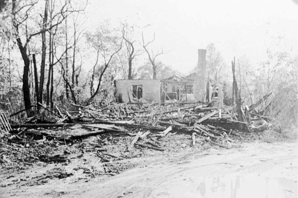 Remains of Bishop Blacksmith shop following 1980s fire. Photo courtesy Sandy Ground Historical Society.
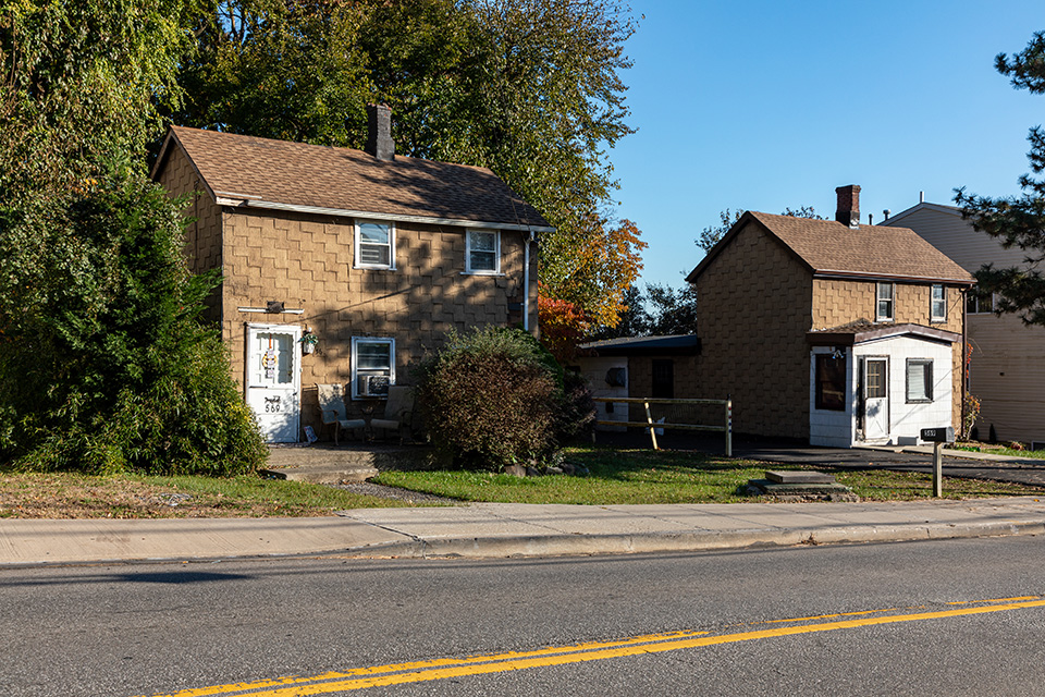
While the cemetery and a number of extant structures, including a few dozen homes—three of which are city landmarks—and the church remain, continued development and under recognition of the significance of this cultural landscape continue to threaten these remnants of an important layer of New York City’s history.
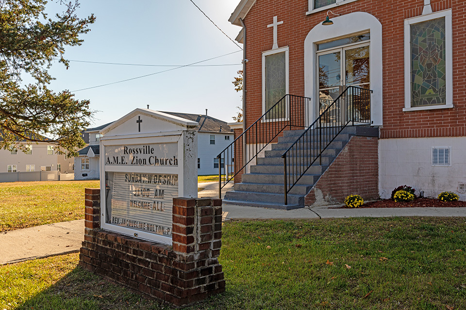
Photo by Barrett Doherty, 2021.
Threat
Despite the many hardships that the community faced throughout the twentieth century, the church continues to be a backbone for the community to this day, and several descendants still live in the neighborhood—though their numbers are dwindling. The church remains active, with services every Sunday, and a host of other community events throughout the year. However, this community faces several distinct threats.
First, the environmental challenges of a waterfront community are acutely felt at Sandy Ground. Staten Island was among the hardest hit during Hurricane Sandy in 2012, and the entirety of the southern shore of Staten Island faces imminent and persistent threat due to sea level rise.
Furthermore, the South Shore has been significantly developed in recent years, and though several extant structures, including various homes and the Rossville Church, are landmarks, that does not preclude further losses to the rest of the neighborhood from encroaching development. New buildings and amenities have already been constructed all around the protected historic structures, effectively destroying their physical connection to each other and the visual and tangible continuity of the neighborhood. The result of continued development could be piecemeal preservation, without respect for, or acknowledgement of, the cohesive community.
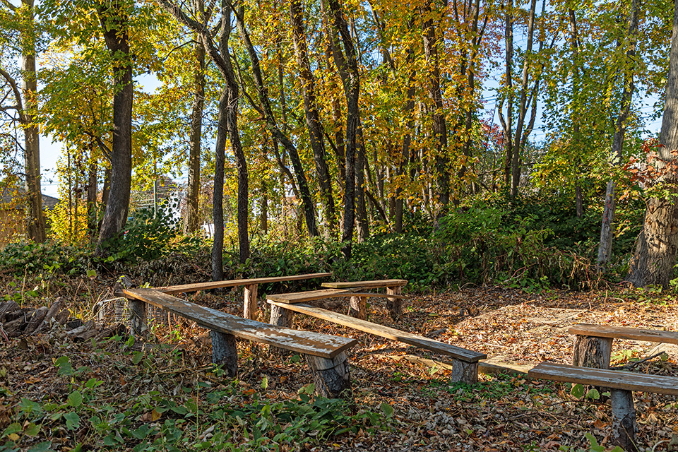
Though the Sandy Ground Historical Museum researches, preserves, and promotes the history of this significant community, and components of Sandy Ground have received protection via listing in the National Register of Historic Places in 1982 (as “Sandy Ground Historic Archaeological District”) and the landmarking of the cemetery in 1985, and several structures in 2011, “Sandy Ground” does not appear as a named community in maps contemporary with its heyday. As is the case with many of the cultural landscapes found in Landslide 2021: Race and Space, and more broadly, throughout BIPOC history in the United States, there were no delineated boundaries at Sandy Ground—the community was fluid, and contained by its human interactions, rather than geographical markers. The physical remains of Sandy Ground today, its specific intact structures, are one small piece of a larger story.
In 2015 more than 500 unmarked graves were discovered at the Rossville AME Zion Church Cemetery. Funded by an $18,000 grant, the New York Landmarks Conservancy oversaw the surveying of the landscape, culminating in the issuance of a Cultural Landscape Report, which documents the findings and presents recommendations for future maintenance. This is just one layer of history that has lain unseen for a century or more. The vast majority of the community’s tangible heritage has already been erased; while the descendants who are reviving and enlivening the church and its environs now are reforging connections to the land, much will never be recovered.

What You Can Do to Help
Donate to the Rossville AME Zion Church.
Donate to the Sandy Ground Historical Society (operators of the museum), to support their ongoing research and programmatic efforts in the community.
Contact Staten Island’s Community Board 3, to express concerns about overdevelopment in the Rossville neighborhood; and participate in Community Board Land Use meetings (many currently being held via Zoom):
1243 Woodrow Road, 2nd Floor, Staten Island, New York 10309
Phone: 718-356-7900
E: sicb3@cb.nyc.gov
Send a Message to New York City Mayor Eric Adams asking him and his administration to prioritize the preservation of Sandy Ground as a distinct and valuable neighborhood on Staten Island by preventing further development in the area and encroachment on historic structures.
Support the Young Leaders of Staten Island in their efforts to raise awareness about the history of Sandy Ground, and to fund the revitalization of the museum.
Visit the Rossville AME Zion Church, learn from Reverend Nolton and the ten original families who remain in this community, and experience the history of the site and its surroundings.
-
Photo by Barrett Doherty, 2021.