One of only two extant suburbs designed by the Olmsted firm in Canada, Scarboro’s curvilinear parkways, natural topography, and rigorously controlled development guidelines represented a departure from the typical railway towns developed in Calgary at the turn of the twentieth century. Unrecognized as a heritage asset by the local and provincial government, the community is at risk of being irreversibly altered by encroaching developments unsympathetic to local historical and physical context.
History
The transcontinental Canadian Pacific Railway (CPR) was established in 1867 under the first Canadian prime minister John McDonald to link the newly united provinces and territories on the east and west coasts. An 1881 agreement between the railway and the Canadian government granted the CPR 25 million acres of land along the railway right of way, on which the CPR developed townsites served by rail stations. In the western territory of Alberta, the Townsite of Calgary was subdivided from four CPR land parcels south of the Bow River in 1884, and the settlement became incorporated as a city a decade later. The city’s population quadrupled between 1906 and 1911, during which the CPR developed its land holdings as residential neighborhoods. In 1907, three parcels of land were annexed for the development of residential suburbs in Calgary. The final subdivision, Sunalta (a portmanteau of “sunny” and “Alberta”), was planned to appeal to the growing middle class. The first plan for Sunalta was developed in 1909 and largely followed the precedent for CPR towns, characterized by rectilinear grids of streets and avenues with uniformly sized residential lots. The CPR’s assistant land commissioner Jacob Lonsdale Doupe engaged John Charles Olmsted of the Olmsted Brothers firm to advise on the second phase for Sunalta Addition in 1909.
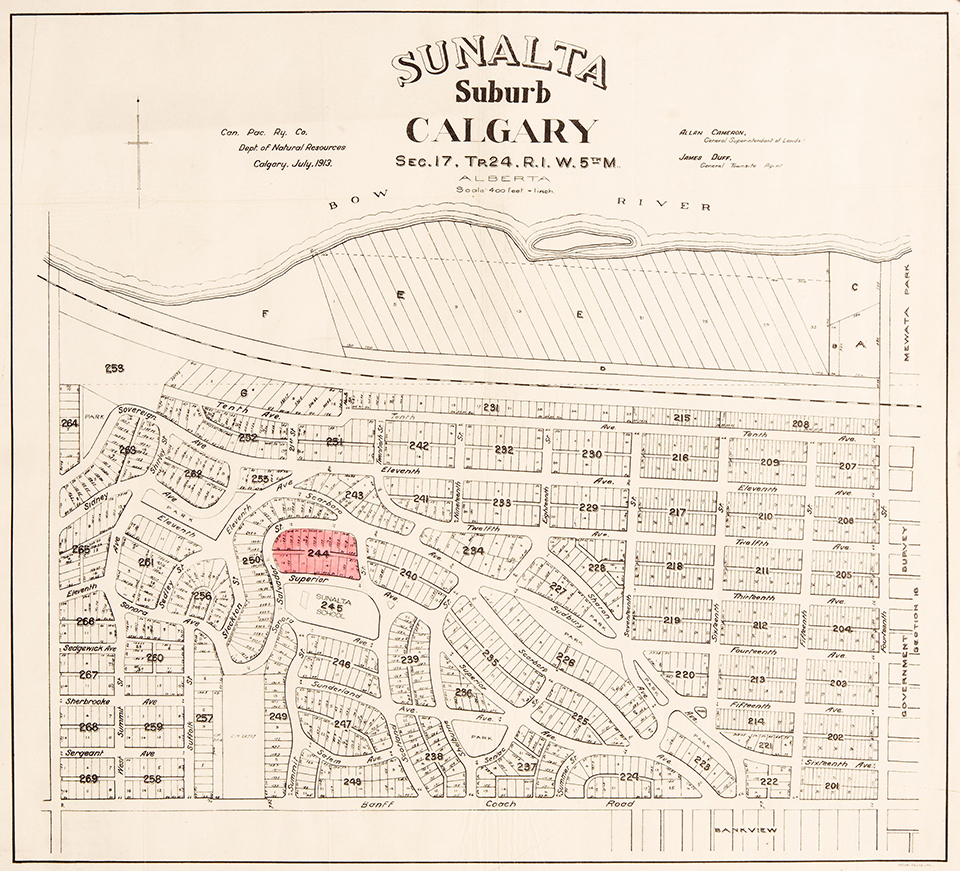 Sunalta Suburb, Calgary, Alberta, 1913, by Canadian Pacific Railway Company. Courtesy of Libraries and Cultural Resources Digital Collections, University of Calgary.
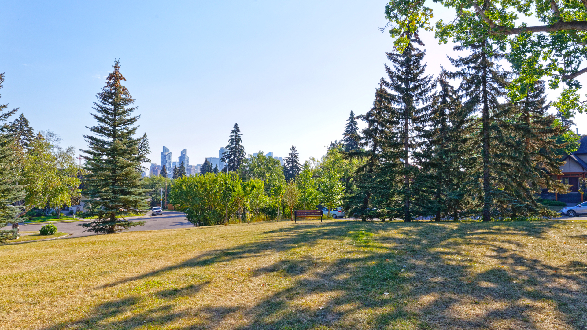
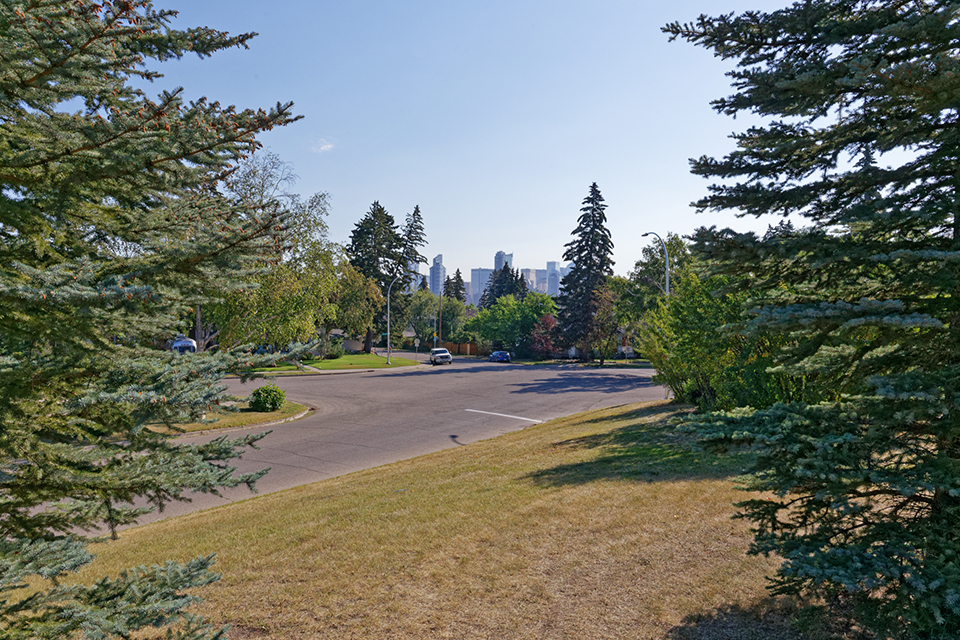
At “Upper Sunalta,” Olmsted appreciated the advantages of the neighborhood’s location along the brow of an embankment overlooking the Bow River. His plan lays lightly upon the land, with curvilinear boulevards and streets following the site’s natural topography. Both natural and manipulated landforms, including a nearby sandstone quarry (closed in 1915), were creatively employed to imbue the neighborhood with a distinctive character. Along the parallel drives of Scarboro and Superior Avenues, residential lots sit atop a natural bluff with sweeping views of the downtown skyline beyond. Twelve percent of the total land area was dedicated to parkland, with several small, triangular parks set at street intersections to encourage neighborhood interaction. Royal Sunalta Park, originally four adjacent, smaller parks, was developed below a steep escarpment with native understory plant materials softening and stabilizing the slopes. The Scotland Street Plot, the smallest dedicated public open space of the Olmsted plan, was enhanced by Calgary parks superintendent William Reader with a rustic wooden fence and understory plantings. Along residential drives, existing shrubs and trees, including native aspen, willows, and hazels, were retained as much as possible, with new canopy trees planted to provide shade and shelter. Reader and the city parks department continued to embellish the neighborhood’s parks with cottonwood, birch, ash, maple, fir, Russian poplars, and spruce trees, as well as an understory of flowering trees that included chokecherry, dogwood, and lilac.
In addition to Upper Sunalta, the Olmsted firm was also engaged at this time to develop plans for several other suburbs in Canada, including Bridgeland and Upper Mount Royal in Calgary; Uplands, in Victoria, British Columbia; and an industrial village near Winnipeg, Manitoba. Of all these plans, only the designs for Upper Sunalta and Uplands were fully implemented and remain extant. Part of the success of these suburbs belongs to the Olmsted firm’s rigorous commitment to controlled development. Riverside, the Illinois suburb designed by Olmsted, Sr., and Vaux in the 1860s, was among the first to be governed by building restrictions. At Upper Sunalta, John Charles Olmsted stipulated 30-foot or twenty-foot setbacks, depending on the street, and restricted the neighborhood residences to include only single-family dwellings. A complicated set of property use and building development restrictions, known as the Anderson Caveat (named in honor of real estate agent George Anderson), came into effect at Upper Sultana on April 5, 1911. By 1921, the neighborhood designed by Olmsted had come to be known as ‘Scarboro,’ distinct from the earlier Sunalta neighborhood laid out by CPR.
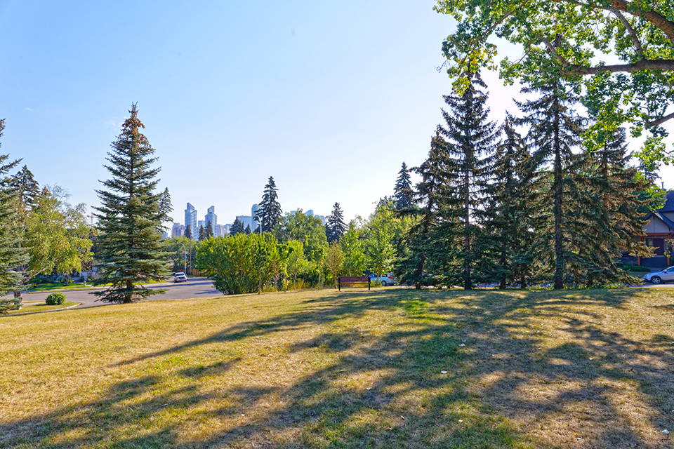
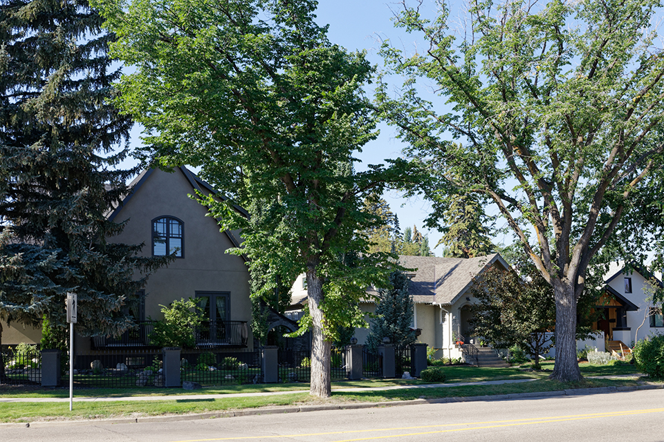
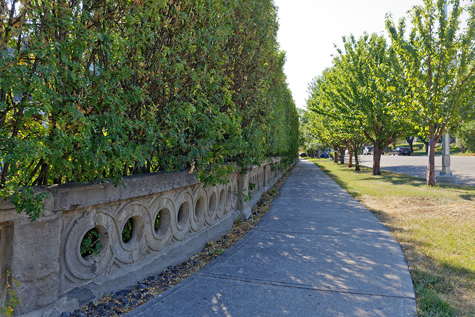
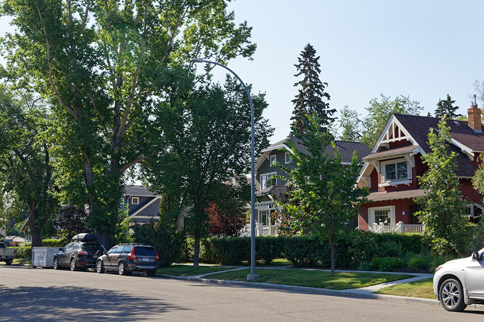
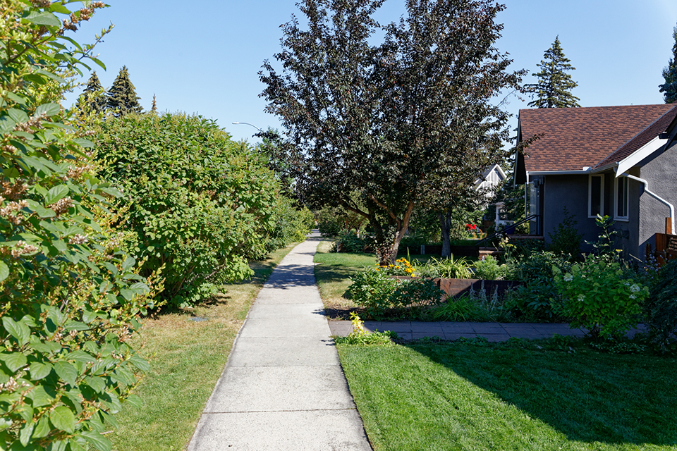
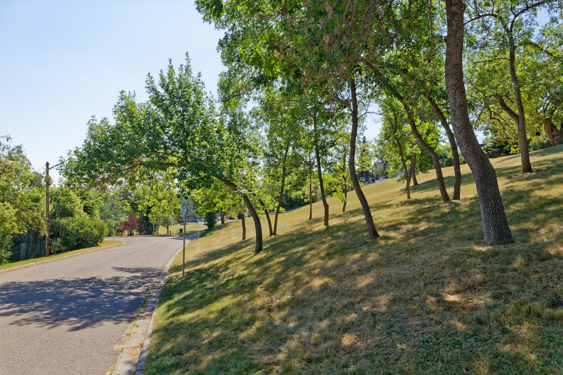
 Scarboro, Calgary, Alberta, 2022. Photo by James Reid.
Through building booms and busts, Scarboro experienced steady growth and continued to attract a middle-class population. During the Great Depression, considerations of converting single-family dwellings into duplexes or apartment suites first arose as homeowners sought to increase their income by renting parts of their property. Conversion became a trend in Calgary, fueled by a housing shortage. In 1934 the Scarboro Community Association was founded to provide community programming, oversight, and maintenance. Although not legally binding like zoning restrictions, or as protective as a historic district boundary, the neighbor-to-neighbor enforcement of the caveat by the community association has been successful in keeping Scarboro’s character, as envisioned by Olmsted, intact. Most new residences and additions have remained sympathetic to the neighborhood’s architectural character, and individual homes are eligible for heritage protections. However, with limited power to safeguard the integrity of the neighborhood, the caveat’s ability to protect Scarboro’s streetscapes and parks from powerful and encroaching development pressures becomes ever more vulnerable.
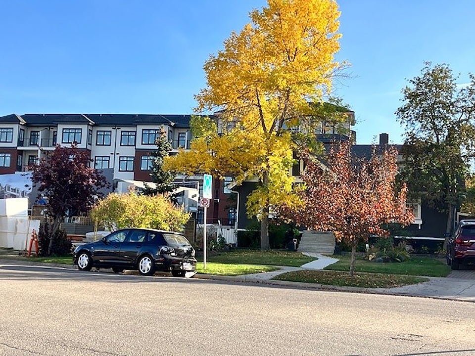
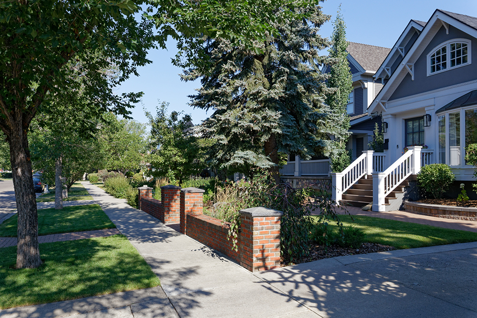
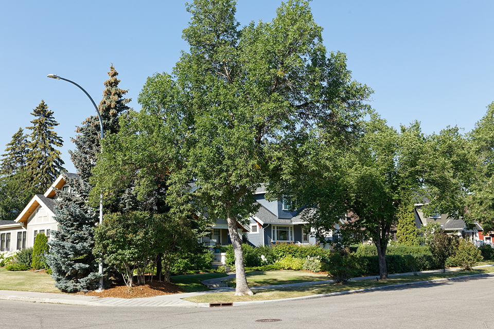
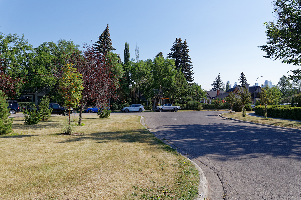
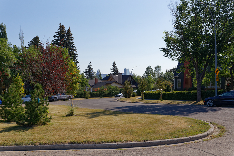
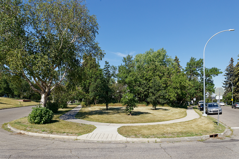
Photo by Tarra Drevet.
Threat
Applications to remove the caveat’s restrictions on individual properties to add residential infill or introduce new commercial uses increased in the 1970s, and since that time, such pressures have mounted. In 2017, a developer acquired the site of a former funeral home, constructing a 52-unit townhome complex, significantly altering the scale and character of the neighborhood block.
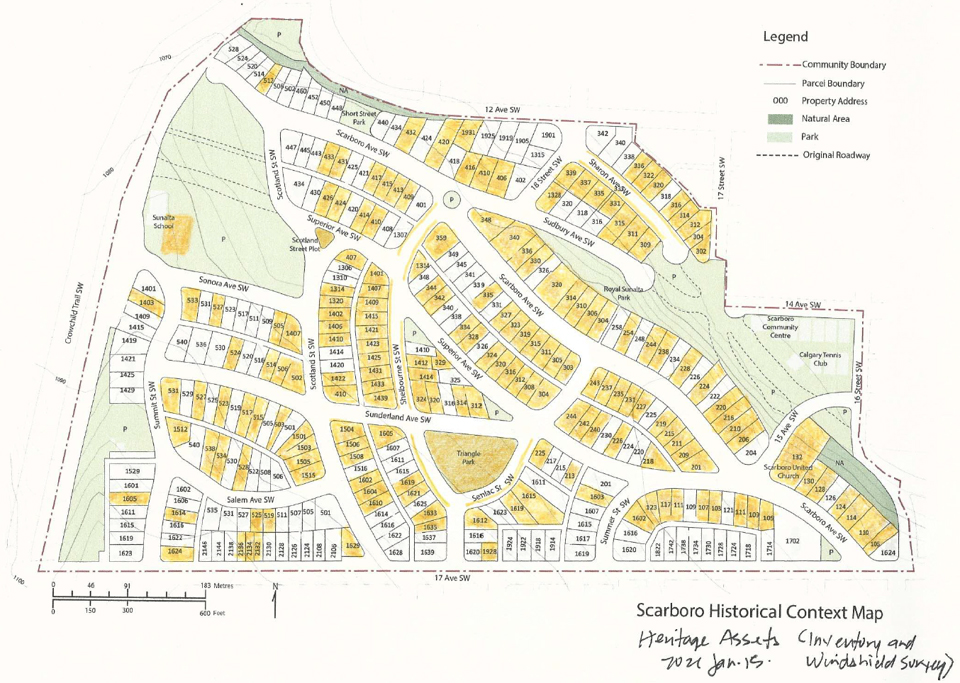
The appetite for preserving and protecting conservation areas in Alberta through city planning measures has been extremely limited, and there is not a substantial team of dedicated heritage professionals employed by the city, in comparison to other cities of comparable size. Although individual public parks and boulevards—including three boulevards (Shelbourne Street SW, Senlac Street SW, and Sharon Avenue SW) and two parks (Triangle Park and Scotland Street Plot) in Scarboro—are protected as municipal heritage resources, the Olmsted plan for Scarboro as a complete entity is not protected as a heritage area (in Calgary, a Direct Control Heritage Area refers to an area containing 50% or more identifiable heritage assets where property owners opt to receive a unique set of mandatory restrictions and allowances). The Scarboro Community Association commissioned a comprehensive Historical Context Paper on Scarboro and submitted it to Heritage Calgary, the first step in the process of pursuing designation. Although the document thoroughly outlines the neighborhood’s heritage value, its admission into Heritage Calgary’s inventory remains stagnated by municipal diffidence towards certifying historic districts.
Calgary previously published Area Redevelopment Plans to articulate community values and local context, including policies that guided infill development to be sensitive to elements such as parcel layout, setbacks, roof pitch, density, massing, scale, and landscape. However, Calgary adopted a new approach to multi-community area planning in 2019, with large district plans of up to sixteen communities that are less specific and less sensitive to local historical and physical context. Local Area Plans give communities less power to articulate their significant local character and to oppose new development that is not contextually sensitive. The approach for next generation planning in Calgary seeks to issue new Local Area Plans for the entire city, along with a renewed land use bylaw that allows for greater density, massing, and types of housing in historic areas. Local Area Plans do include some policies for heritage resources, but none apply to entire neighborhoods with heritage value. The Scarboro Community Association submitted a letter to city officials requesting that a heritage district guideline tool be added to address areas larger than one side of a block within established communities, but their request was not met. Local Area Planning continues in Calgary, with new land use bylaws slated to be introduced in 2023-2024.
(above) Scarboro Historical Context Map. Image courtesy of Tarra Drevet.
What You Can Do to Help
Write to officials at the Provincial Government of Alberta, City of Calgary and Heritage Calgary to urge that Scarboro be designated as a cultural landscape included on Calgary’s Inventory of Evaluated Historic Resources and considered as a direct control heritage area for the purposes of Local Area Planning.
Government of Alberta:
Ron Orr, Ministry of Culture
Larry Pearson, Director of Historic Places Stewardship
Rebecca Goodenough, Historic Places Research
and Designation Manager
City of Calgary:
Office of Jyoti Gondek, Mayor of Calgary
Mr. Stuart Dalgleish, General Manager, Planning & Development Services; Deputy City Manager
Courtney Walcott, Councillor for Ward 8
Ian Harper, Senior City Planner
Heritage Calgary:
Mr. Josh Traptow, CEO
Cynthia Klaassen, Heritage Resources Program Manager
Donate to the Scarboro Community Association’s Anderson Caveat Enforcement Fund to assist community members with enforcing and abiding by the controlled development guidelines laid out in the Olmsted plan.
To find out more contact: caveat@scarborocommunity.com
-
Image courtesy of Scarboro Community Association.