Built between 1790 to 1791 by Kamehameha the Great on the northwestern coast of the island of Hawai'i, the Puʻukoholā Heiau temple symbolizes the birth of the modern Kingdom of Hawai'i and is now a national historic site. Constructed of lava rocks and consecrated with the sacrifice of a political rival, the temple precinct was meant to fulfill the fourth and final prophecy that would aid Kamehameha’s rise to power. But today, rising tides, ocean acidification, and invasive species threaten to irreversibly alter the only historic landscape that is directly linked to the unification of the Hawaiian Islands.
History
The long-standing political equilibrium and isolation of the Hawaiian Islands ended with the arrival of Captain James Cook’s ships in 1778. Prior to that time, the islands were divided among four to six kingdoms and were home to a society that was itself divided into three main social classes: ali’i (chiefs), maka’ainana (commoners), and kahuna (priests). The ali’i maintained a monopoly on property and material goods, while the maka’ainana worked the land.
 Signed photograph of Liliuokalani, the last sovereign of the Hawaiian kingdom. Notation on recto – “To the Hon. Josephus Daniels, Secretary of the Navy, from Liliuokalani, HawaiI, 1916”, photo courtesy Library of Congress, ca. 1890-1900.
The unification of the Hawaiian Islands into one kingdom began with a series of battles waged by Kamehameha I and lasting nearly thirty years. An ali'i nui (high chief), Kamehameha had gained control of the western and northern sections of the island of Hawai'i by 1782. Having also gained considerable power, he aimed to bring the entire island under his rule—something that had rarely been achieved in the past—but his conquest stalled with a series of inconclusive battles.
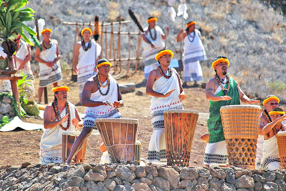
A priest, it is said, advised Kamehameha to build a luakini heiau (a temple for human sacrifice) in the area of Waiku’i in order to gain the favor of Kūkaʻilimoku, his family’s war god. As places where traditional Hawaiian deities are worshipped and devotees receive mana, each heiau served a different purpose, such as increasing agricultural yields, honoring one's ancestors, or bringing victory in battle. In this case, the dedication of the structure also served as a ruse to lure and kill Kamehameha’s rival, Keōua Kuahuʻula, chief of east Hawai’i (Hilo, Puna, Ka’u, and part of Hamakua), who attended the ceremony intending to negotiate peace. Keōua, however, became the first victim of sacrifice on the temple’s altar in 1791.
Kamehameha was thereafter victorious in battle. He had captured the Kingdom of Maui by 1794, and the Kingdom on O'ahu likewise fell to him in 1795. After the peaceful surrender of the Kingdom of Kauai in 1810, Kamehameha I became the first ruler, and Pu’ukoholā Heiau became the first seat of government, of the newly united Kingdom of Hawai‘i. The reign of the House of Kamehameha brought the islands onto the global stage, leveraging their strategic location and opening a new world of foreign trade. Meanwhile, the influence of ali'i over the monopoly of land declined. The rise of a prosperous whaling industry in the 1820s brought approximately 150 ships to Hawai'i’s Kawaihae Harbor annually. And by 1835, the first commercially viable sugar plantation had been established, leading to growth of the sugar industry and subsequent large-scale exports to the United States.
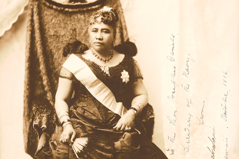
The dynasty established by the House of Kamehameha would last until 1874. The United States formally recognized Hawaii's independence in 1846 under the reign of Kamehameha III. But the Kingdom of Hawai’i would only continue for another 21 years. On January 17, 1893, a group of businessmen and sugar planters, organized under the guise of the “Committee of Safety,” forced Queen Liliuokalani, of the House of Kalākaua, to abdicate her throne. The efforts were backed by U.S. Government Minister John L. Stevens and a contingent of U.S. Marines, who came ashore to support the overthrow. The coup d'état established the short-lived Republic of Hawai’i, but the ultimate goal was the annexation of the islands to the United States, which finally occurred in 1898.
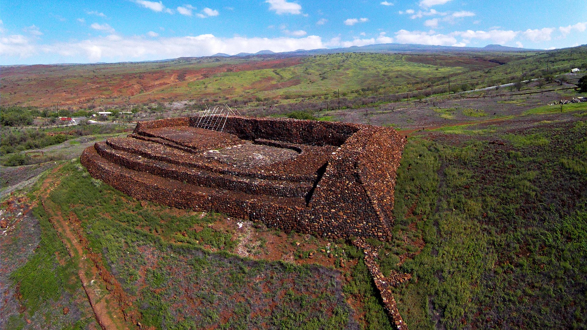
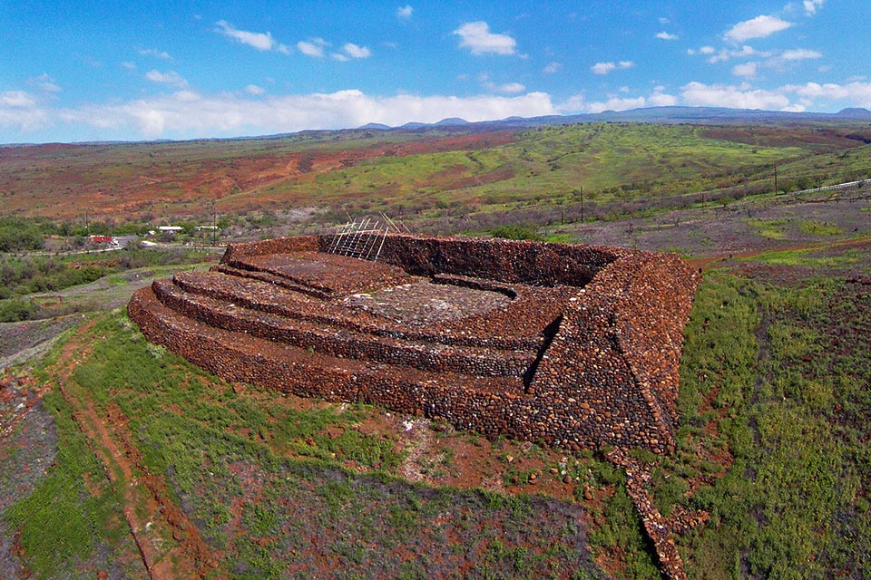
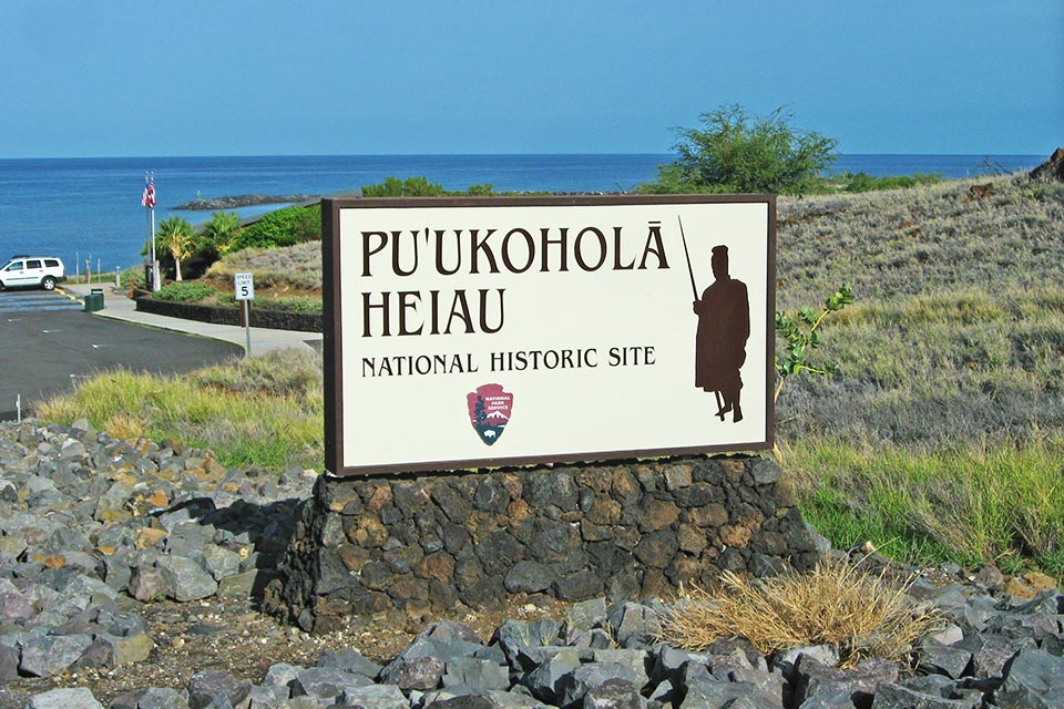
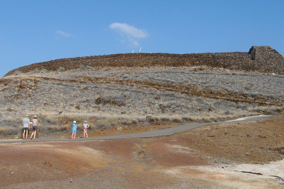
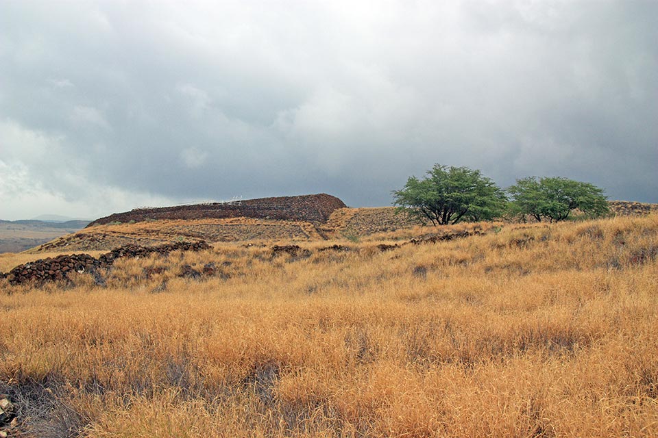
On August 21, 1959, Hawaii was admitted to the Union, becoming the 50th state. In 1962 Puʻukoholā Heiau was designated a National Historic Landmark. A subsequent donation of 34 acres of land by the Queen Emma Foundation helped establish the Pu’ukoholā Heiau National Historic Site on August 17, 1972. The irregularly shaped site stretches from the Pelekane Beach in the west to I-270 in the east, and to Makahuna Gulch in the north. Possibly built upon the site of a sixteenth-century temple, the massive, roughly rectangular heiau overlooks Kawaihae Bay from “the hill of the whale.” To the northwest lie the ruins of Mailekini Heiau, used by Kamehameha and his ancestors, while the Hale o Kapuni Heiau is submerged along the western shore, built for the shark gods along the Kohala coast.
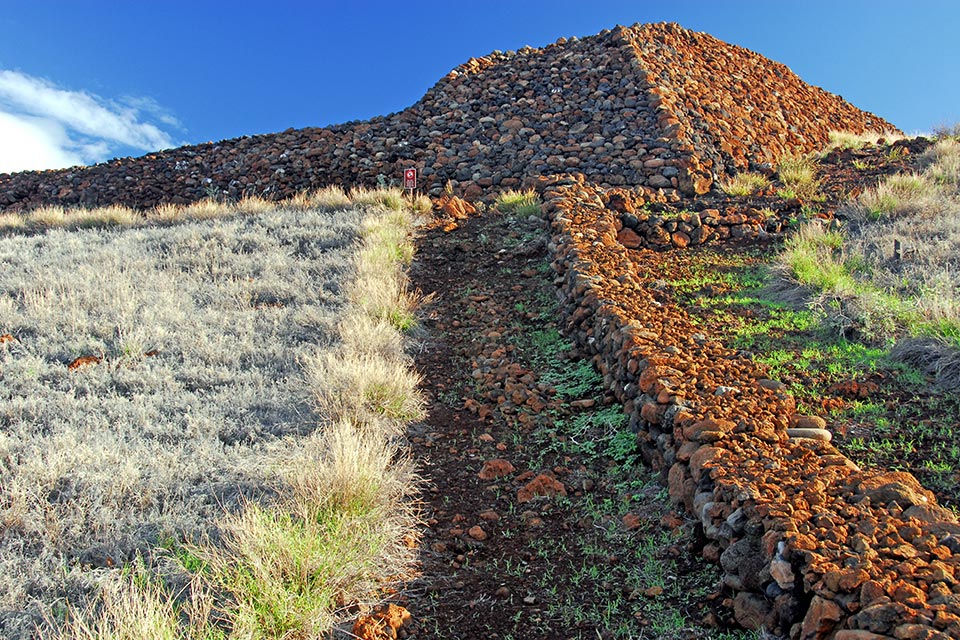 Constructed of lava rocks, Puʻukoholā Heiau was built from 1790 to 1791 by Kamehameha the Great; photo by Bamse, 2007.
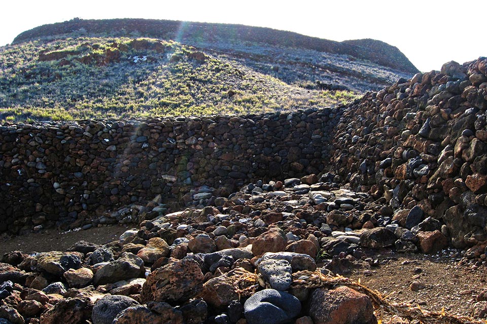
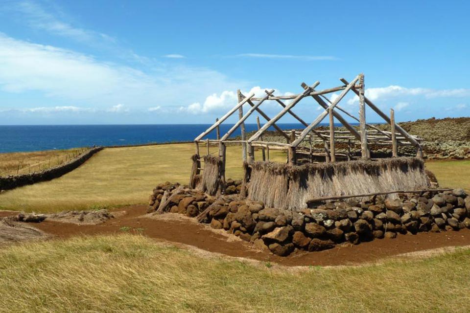
The last known polytheistic temple built in Hawai'i, the Puʻukoholā Heiau is 224 feet long and 100 feet wide. Constructed with fieldstone and water-worn lava rocks precisely set without mortar, the structure is said to have required the labor of several thousand workers. Forming a human chain, they transported stones from the Pololu Valley, more than twenty miles away. Among the many who witnessed this construction were Isaac Davis and John Young, sailors from the American schooners Eleanora and The Fair American who aligned themselves with Kamehameha I and went on to become his military advisors. Appointed the royal governor of Hawaii in 1802, Young is responsible for the first stone dwelling built in a European style on the island, whose ruins lie along the northern boundary of the historic site.
The North Kohala district, where the heiau is located, was a major agricultural center with coastal settlements sustained by subsistence farming and fishing. Much of the water supply along the coast was brackish and remains so today despite the increase in waterfront tourist development. The parkland also hosts brackish anchialine pools that are sustained by porous substrates such as the lava flows. In the United States, this aquatic feature is restricted to the Hawaiian Islands and is the only known habitat of Ōpae'ula, the native Hawaiian Red Shrimp.
Threat
In Hawai'i, average air temperature has risen by 0.76 degrees Fahrenheit over the past 100 years, which is on par with global trends. This has already triggered changes in precipitation patterns that are altering the historic site’s ecosystem. Regular trade winds that typically blow from the northeast are a characteristic feature of the climate in the Hawaiian Islands. Winds break across the northeastern, or windward, sides of the landmass, causing rainfall and creating lush windward—and drier leeward—areas of the islands. These patterns of precipitation sustain the parkland’s freshwater supply. However, recent studies demonstrate a 30 percent decrease in the frequency of trade winds over the past three decades alone, a phenomenon that has been linked to climate change. While freshwater has always been scarce in the Kawaihae region, the most extreme drought in the state’s history occurred on Hawaii in 2008. The drought was but one datum in a decades-long trend of decreasing rainfall on the Hawaiian Islands, as aggregate temperatures increase and storms become more extreme. Without adequate rainfall, native ecosystems and the delicate ecology of the anchialine pools found along the historic site are threatened.
Meanwhile, the State of Hawaii is also bracing for an estimated 3.2 feet of mean sea level rise by the year 2100, although destructive flooding is expected to occur regularly beginning in 2040. Although Puʻukoholā Heiau is not immediately susceptible to sea-level rise, the surrounding low-lying parkland, including the Mailekini Heiau and the underwater Hale o Kapuni Heiau, will certainly experience erosion from near-shore flooding. Rising sea levels and groundwater tables also threaten the anchialine pools, which could either disappear or become connected with other water systems, thereby spreading invasive species further inland. This could devastate local wildlife populations and accelerate extinction.
What You Can Do to Help
As sea-level rise and drought-inducing conditions develop slowly, there may be no clear trigger for implementing adaptive strategies. Having current, continuous, and spatially appropriate observations of climate variables is crucial for noticing and responding to changes in long-term climate, but in Hawai'i, as in many places, the number of long-term monitoring stations is threatened and decreasing due to costs and the growing preference to fund analysis rather than data-collection networks. The Puʻukoholā Heiau National Historic District is now listed under the Pacific Island Inventorying and Monitoring Network, which can help fill that gap. Other programs, such as the Pacific Regional Integrated Sciences and Assessments Program (Pacific RISA), administered by the East-West Center and funded by the National Oceanic and Atmospheric Administration, work directly with natural-resource managers in the Pacific Islands region to produce actionable science that can help reduce potential vulnerability and increase resilience.
Those wishing to help protect the Puʻukoholā Heiau National Historic Site can volunteer their time or make a tax-deductible donation. To learn about volunteer opportunities and to help support the park's climate-adaptive initiatives, please contact park staff directly at (808) 882-7218. Mahalo for your support!