The three sites featured below – Bears Ears National Monument in Utah, Boundary Waters Canoe Area Wilderness in Grand Marais, Minnesota, and Coyote Valley in San Jose, California – along with two others included in this year’s report (Fort Negley and the Rhode Island State House Grounds) were featured in TCLF’s 2017 Landslide report and digital exhibition, Open Season on Open Space. Katarina Katsma, ASLA, writing for Landscape Architecture, observed that the report “minces no words on [its] subject, calling out municipalities, states, and the federal government for undermining a century’s worth of progress for our public lands, parks, and national monuments.”
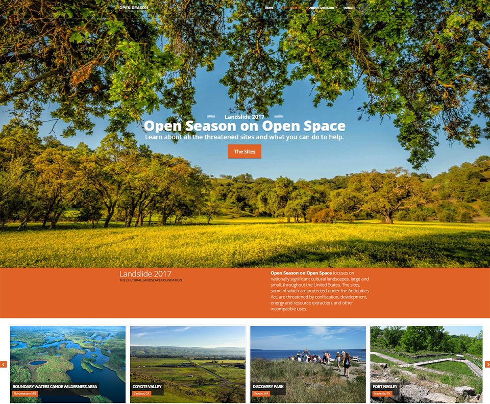 Landslide 2017: Open Season on Open Space homepage. Image courtesy The Cultural Landscape Foundation.
Cultural landscapes are frequently at risk because open space is too often viewed as empty space, treated as a void absent of any cultural significance, waiting to be filled. This tabula rasa approach can lead to landscapes being viewed as ripe for resource extraction, development, or confiscation; the palimpsest of histories contained within them are subject to erasure. Just as many European colonists viewed America as a “new world,” lacking in “civilization” and ready to be settled, today many traditional cultural lifeways are equally unseen, unrecognized, and thus discounted and devalued. Bears Ears National Monument, Boundary Waters Canoe Area Wilderness, and Coyote Valley are significant culturally and ecologically essential areas that have been caught in the political crosshairs as administrations and agendas have changed; all three have been protected through coalitions of individuals and organizations that have included TCLF amongst their numbers.
Advocacy in one arena frequently overlaps with another. Advocating on behalf of threatened landscapes often also involves advocacy for greater racial, gender, and social equity and justice, and for landscapes that are imbued with meaning and history for marginalized groups. In the context of the struggle for civil rights, Martin Luther King Jr. once stated that “too many people fail to remain awake through great periods of social change. Every society has its protectors of status quo and its fraternities of the indifferent who are notorious for sleeping through revolutions. Today, our very survival depends on our ability to stay awake, to adjust to new ideas, to remain vigilant and to face the challenge of change.” The sites below have been saved; nevertheless, the coalitions that have been built must grow stronger and “remain awake.”
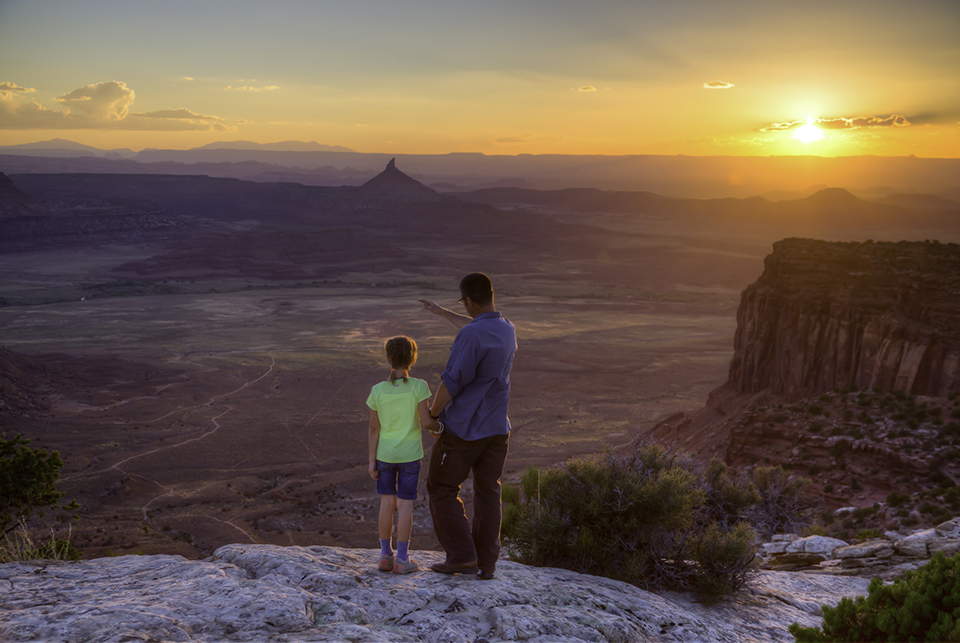
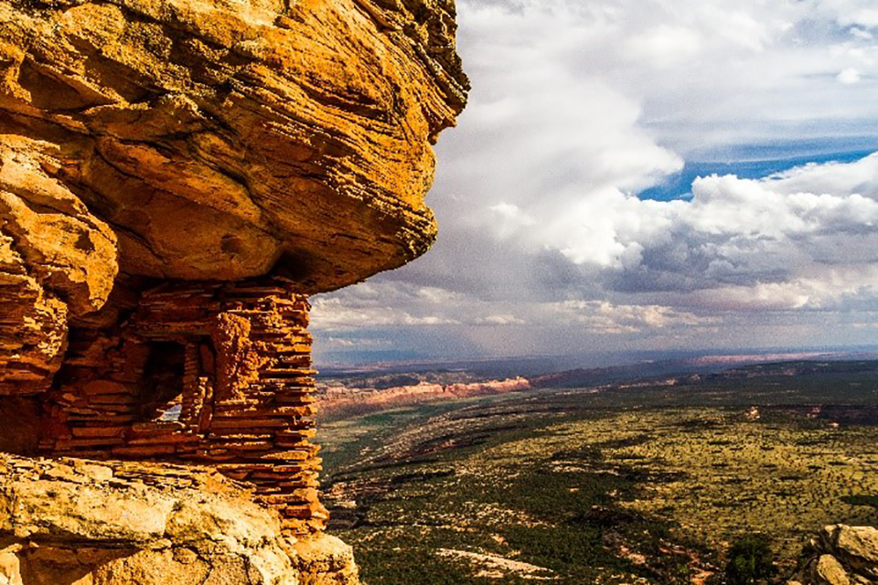
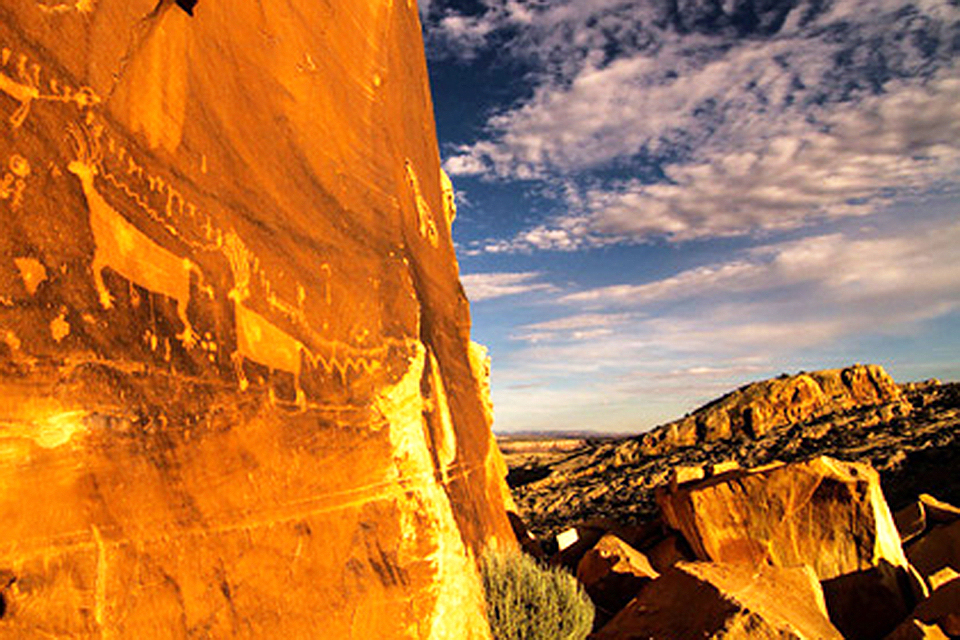
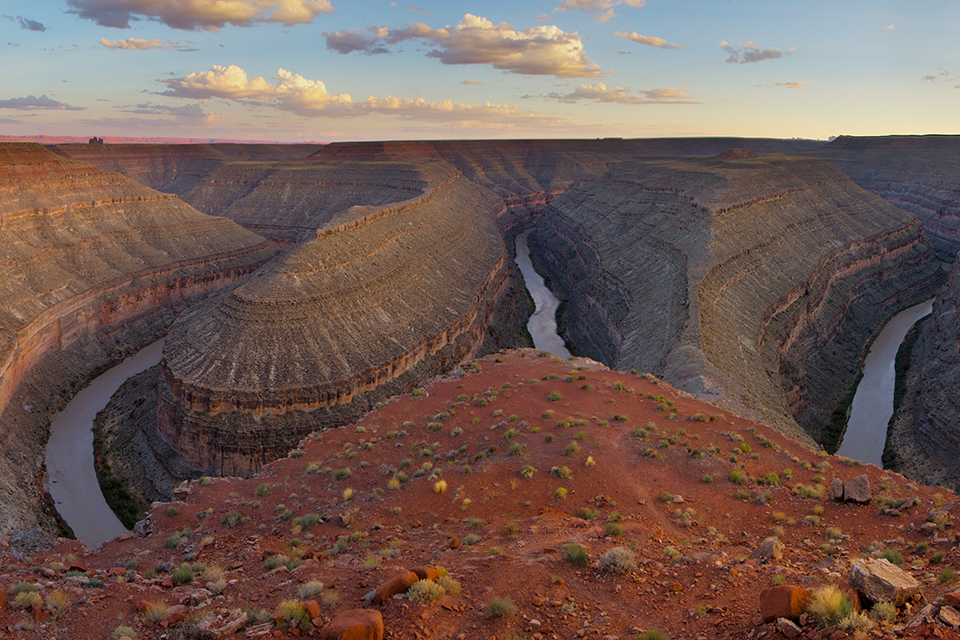
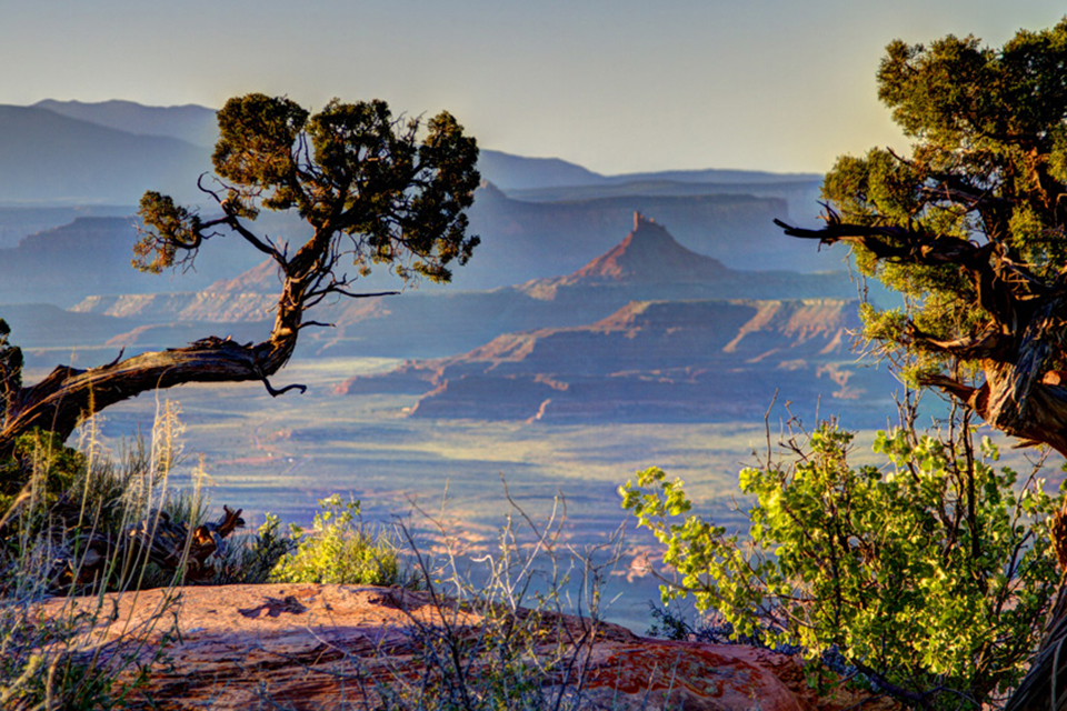
Towering sandstone spires, deep labyrinthine canyons, meadow mountaintops, and the eponymous twin buttes seen from nearly every direction in the southern Utah landscape characterize this archaeologically and culturally significant site. Some 13,000 years ago, the Clovis people were active here; 2,500 years ago, ancestral Puebloans constructed cliff-side dwellings with underground rooms called kivas. In 1880 Mormon settlers on the San Juan Mission expedition constructed the Hole-in-the-Rock Trail, listed in the National Register of Historic Places in 1982. Cattle rustlers and outlaws, reportedly including Butch Cassidy and the Sundance Kid, traversed and hid among the landscape’s varied topography, which was also used by the Navajo to elude the U.S. Army.
Background
The 1.3-million-acre monument is bordered by the Colorado and San Juan Rivers to the west, the Navajo Reservation to the south, low bluffs and high mesas to the east and north, and Canyonlands National Park to the northwest. At its center, the Bears Ears Buttes tower above Cedar Mesa, a vast plateau with twelve canyons folding along its sides. Mule deer, elk, bighorn sheep, Utah’s only population of Albert’s tassel-eared squirrels, and numerous other species live among pinyon juniper woodlands and canyons of yucca and cacti within the monument’s boundaries. With its large-scale petroglyphs, the mostly roadless site records Native American lifeways and continues to support traditional events, such as medicinal and ceremonial plant collection. Throughout the twentieth century Native Americans returned to the Bears Ears area for spiritual ceremonies and, in the 1930s, began advocating to protect it under the Antiquities Act of 1906. Responding to a 2015 petition from the Bears Ears Inter-Tribal Coalition, a group comprised of five federally recognized tribes, President Barack Obama declared Bears Ears a national monument in 2016.
 Bears Ears National Monument, UT, 2016. Photo by Bob Wick, courtesy Bureau of Land Management.
Bears Ears first came under attack in 2017 when President Donald Trump issued an executive order for a status reassessment of 27 national monuments, including Bears Ears, to open areas for energy extraction, claiming insufficient public outreach before designation. Eight months later, Bears Ears National Monument was reduced from 1.5 million to only 220,000 acres.
Bears Ears National Monument, UT, Photo © Josh Ewing, courtesy Friends of Cedar Mesa.
Advocacy and Engagement for Bears Ears National Monument
That same year, TCLF enrolled Bears Ears National Monument in Open Season on Open Space. Press coverage included stories in Curbed, The Architects’ Newspaper, Planetizen, and many other outlets.
Although multiple lawsuits were filed by conservation and tribal groups against the federal government, including by the Bears Ears Inter-Tribal Coalition, the Department of the Interior opened the land previously considered part of Bears Ears National Monument to industry activity such as mining and drilling in 2020. In 2021, President Biden reinstated protection of Bears Ears National Monument, along with two other national monuments, using his authority under the 1906 Antiquities Act, noting, “Protection of public lands must not become a pendulum that swings back and forth depending on who’s in public office. It’s not a partisan issue. National monuments and parks are part of our identity as a people. They are more than natural wonders. They are the birthright we pass from generation to generation. A birthright of every American.”
According to The Guardian, at the ceremony interior secretary Deb Haaland, the first Indigenous cabinet secretary, “fought back tears as she applauded the administration’s actions for ‘bending the arc of the moral universe towards justice.’” The following year a first-of-its-kind agreement was signed by the federal government and the Hopi Tribe, the Navajo Nation, the Ute Mountain Ute Tribe, the Ute Indian Tribe of the Uintah and Ouray Reservation, and the Pueblo of Zuni, to co-manage the site. The coalition continues to advocate for and manage Bears Ears National Monument, continuing a tradition of stewardship that has continued over thousands of years.
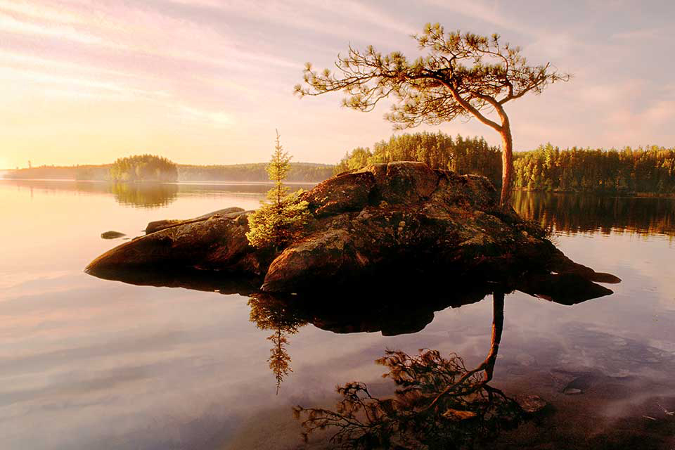
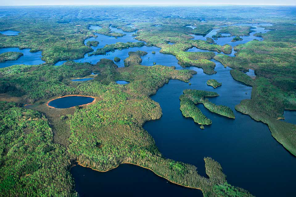
Carved by glacial retreat spanning some 2.5 million years, this vast wilderness covers approximately 1.1 million acres in northeastern Minnesota. Extending 199 miles along the international border, the area is contiguous with Quetico Provincial Park, in Canada, and Voyageurs National Park, in the United States. Canoeing through its waters, Dakota, Ojibwe, and other indigenous peoples established villages, grew wild rice, and crafted siltstone tools, beginning some 10,000 – 12,000 years ago. In the seventeenth century European and French-Canadian explorers traversed the area on trade routes. In 1902 the U.S. General Land Office designated 500,000 acres of the future Boundary Waters Canoe Area (BWCA) as protected from settlement; another 141,000 acres were added in 1905. The site was incorporated into the Superior National Forest, dedicated by President Theodore Roosevelt, in 1909.
Background
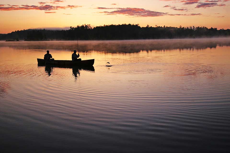
The area is home to a vast network of approximately 1,175 lakes and several hundred miles of streams, which have filled in the depressions left by retreating glaciers. Surrounding cliffs, canyons, and hills (the tallest being Eagle Mountain, at 2,301 feet) harbor dense forest ecosystems. Pine, spruce, fir, and cedar are common, along with wetland shrubs. BWCA is also home to a large population of gray wolves, moose, beavers, bald eagles, and other fauna. Reportedly America’s most visited wilderness area, BWCA has twelve hiking trails, more than 1,200 miles of canoe routes, and more than 2,000 designated campsites. Included in this cultural landscape are historic Ojibwe villages and Native American pictograph sites. BWCA became a unit of the National Wilderness Preservation System when the National Wilderness Act was passed in 1964. Congress ratified the BWCA Wilderness Act in 1978, which ended logging and restricted mining at the site.
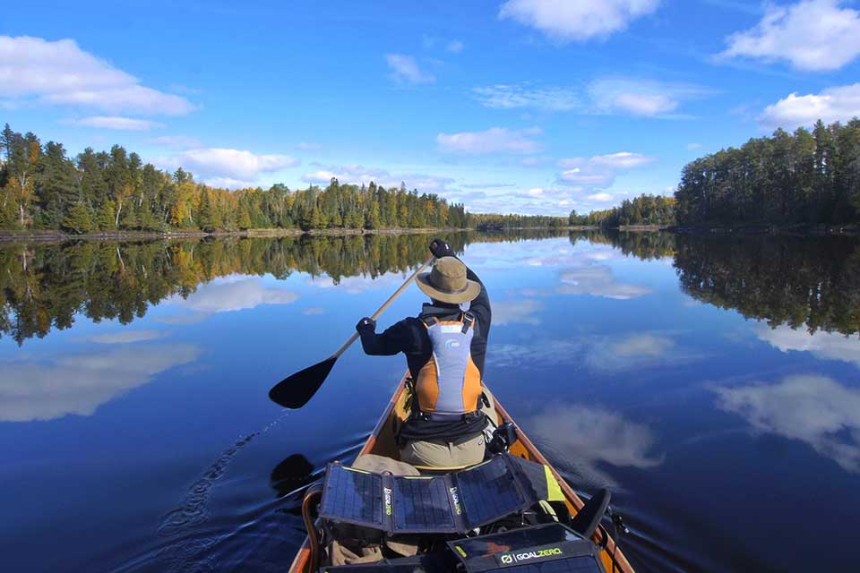 Boundary Waters Canoe Area Wilderness, MN, Photo © Dave Freeman.
Boundary Waters came under attack in 2012 when Twin Metals Minnesota (TMM) proposed a sulfide-ore mining operation along the southern edge of the Superior National Forest, which could release sulfuric acid, heavy metals, and sulfates – all toxic to plant and aquatic life – into the rivers, lakes, and groundwater of the BWCA. In 2016, under the Obama administration, the Forest Service and Bureau of Land Management (BLM) denied the leasing requests, directing the Department of the Interior and the BLM to withdraw 234,328 acres of Superior National Forest from the federal mining leasing program for a period of twenty years. In January 2017, the Forest Service and the BLM commenced an environmental impact statement (EIS) that would guide the decision as to whether the area should be withdrawn from mining, in the meantime putting a two-year moratorium on mining until the final EIS was completed. Later that year the Trump Administration reversed the decision to suspend the mining leases and demoted the in-process EIS to a less thorough environmental assessment. Congressman Tom Emmer of Minnesota introduced a bill in the U.S. House of Representatives that would enable TMM to obtain mining leases in perpetuity.
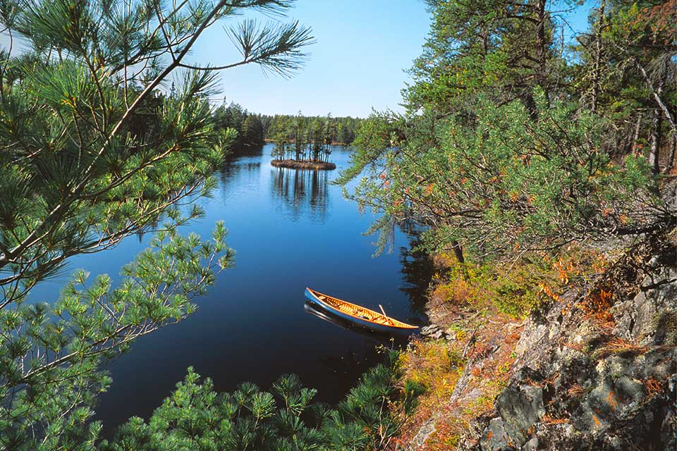
Boundary Waters Canoe Area Wilderness, MN, Photo © Jim Brandenburg.
Advocacy and Engagement for Boundary Waters Canoe Area Wilderness
Following these events, TCLF enrolled BWCA in Open Season on Open Space. The report urged readers to support the work of the conservation coalition, Save The Boundary Waters, a group of more than 300 businesses and national, regional, and local organizations, and to write letters in opposition to Minnesota and Secretary of the Interior and Agriculture representatives.
The threat to BWCA continued to grow as the Secretary of the Department of Agriculture revoked and canceled the nearly completed environmental assessment in 2018, refusing to share the study’s reports with the public. By May 2, 2019, the BLM had reinstated and renewed the previously terminated mining leases. On January 26, 2023, under the Biden administration, the U.S. Department of the Interior signed Public Land Order 7917, withdrawing more than 225,000 acres of land in the Superior National Forest from the federal mines leasing program for twenty years. In August 2023 Representative Betty McCollum introduced a bill, the Boundary Waters Wilderness Protection and Pollution Prevention Act, that, if passed, would permanently protect this site from mining. This legislation is endorsed by a broad range of stakeholders, including, amongst others, Save the Boundary Waters, the Sierra Club, The Wilderness Society, and the Minnesota Chippewa Tribe, including the Bois Forte, Leech Lake, White Earth, Fond du Lac, Mille Lacs, and Grand Portage bands.
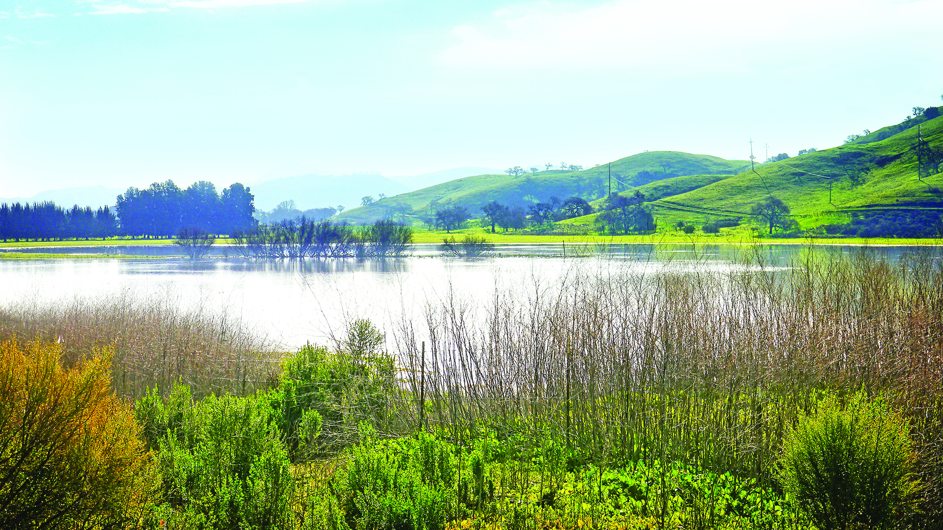
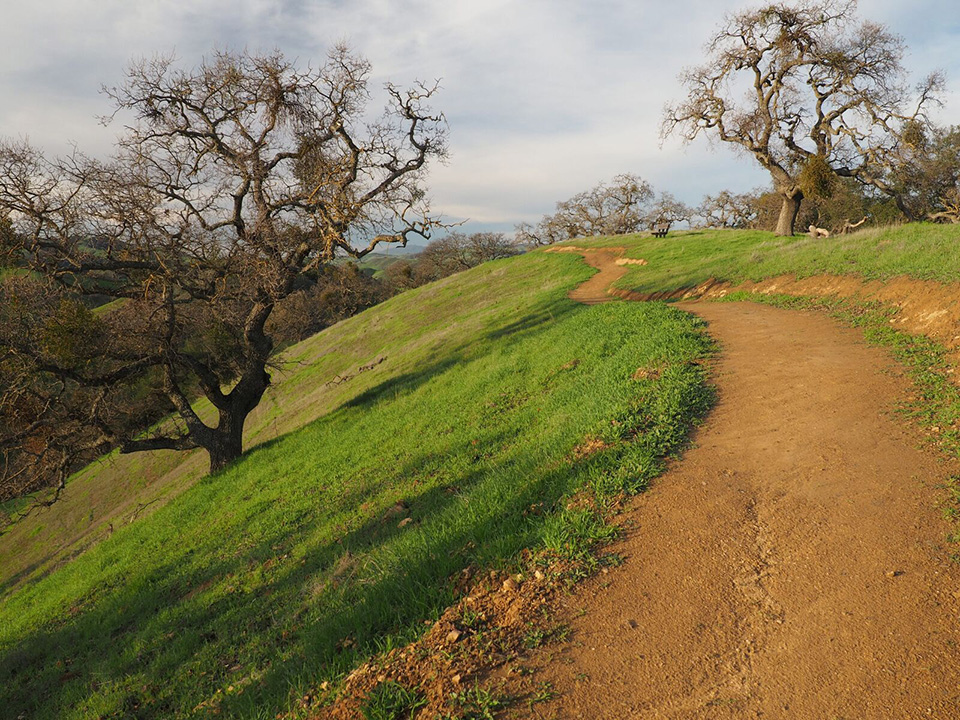
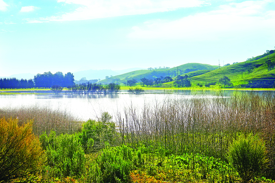
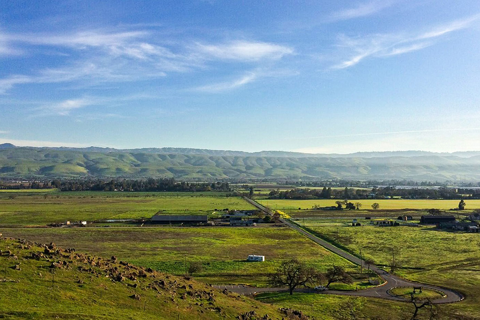
Located in the San Francisco Bay Area, this 7,400-acre valley is the setting for farmland and open space just south of San Jose. The Santa Cruz Mountain Range to the west and the Mount Hamilton Range to the east bound the Coyote Valley, with Coyote Creek and Fisher Creek running through it. The Amah Mutsun and Muwekma Ohlone peoples inhabited the land before Spanish settlers arrived in the 1770s. From the mid-nineteenth century through the twentieth century, the valley became part of an area known as the “Valley of Heart’s Delight,” descriptive of its lucrative agricultural economy. In recent decades, the city of San Jose and its surroundings became known as “Silicon Valley,” due to the world-renowned technology firms located there.
Background
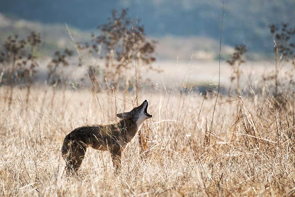
Resting on the southern tip of the primary groundwater basin for San Jose, the valley safeguards the aquifer and 2,500 acres of floodplain. Coyote and Fisher Creeks, traversing the valley, sustain wetland and riparian habitats for migrating steelhead trout and other species of fish. Upland from the creeks, mature oak and sycamore trees dot gently sloping hills covered in grasses and wildflowers. These oak savanna areas support more than 215 species of resident and migratory birds. Coyote Valley is an essential wildlife corridor for mountain lions, bobcats, American badgers, gray fox, coyotes, the western burrowing owl, and other fauna, some of which are critically endangered. Land uses in the valley vary: the IBM Silicon Valley Laboratory, a computer software research facility, is in the north; several farms and Hamlet, a historic village, are centrally located; and rural subdivisions are in the south. The valley also contains water-sport facilities, two golf courses, and the Coyote Creek County Park and Trail system, which reaches the San Francisco Bay.
 Coyote Valley, CA. Photo by Teddy Miller, courtesy the Committee for Green Foothills, 2016.
One of the last, large-scale, unprotected open spaces in Northern California’s San Francisco Bay Area, the valley has been continually threatened by urban sprawl since the 1980s, when it was first designated for industrial development by the city. In many cases, local coalitions successfully thwarted development, but in some cases, such as with the development of the IBM campus in the 1970s and Gavilan College in 2008, they were not as successful.
Coyote Valley, San Jose, CA, 2017. Photo courtesy of Committee for Green Foothills.
Advocacy and Engagement for Coyote Valley
In 2017 a San Francisco-based advocacy group, the Greenbelt Alliance, noted that the City of San Jose’s growth plan called for the development of a jobs center and housing within Coyote Valley. At that time the group successfully nominated the valley for enrollment in TCLF’s Open Season on Open Space. TCLF closely followed, engaged with, and reported on the San Jose’s City Council’s actions concerning the valley, including urging the advocacy of the Greenbelt Alliance.
The following years saw a series of victories for Coyote Valley. In 2018 the citizens of San Jose overwhelmingly approved an infrastructure bond, ‘Measure T,’ at the ballot box, approving $50 million of funding for land conservation acquisition in Coyote Valley. The San Jose City Council unanimously voted in 2019 to approve the purchase of 937 acres in North Coyote Valley for $93 million. Using funds from ‘Measure T,’ the land was purchased by a Palo Alto-based non-profit, Peninsula Open Space Trust, Santa Clara Valley Open Space Authority, and the City of San Jose, with the Santa Clara Valley Open Space Authority managing the entire assembly. In 2021 the San Jose City Council voted unanimously to change the land use designation of North Coyote Valley to open space and agriculture as well as to remove the “urban reserve” designation from Mid Coyote Valley. In addition, the Santa Clara County Board of Supervisors approved a Climate Resilience District for both Mid- and South Coyote Valley, which imposes restrictions on development and supports climate-resilient agriculture.
These victories were spurred on by overwhelming community support as evidenced by thousands of emails sent to the City Council from race equity leaders, business and housing organizations, indigenous tribes, farmers, government agencies, and elected leaders. They represent the culmination of decades of work by local stewards and advocacy groups that have together highlighted the adverse effects of urban sprawl and development on this critically important landscape and wildlife corridor.

Selected Resources
“Trump Administration Reduces Protections for Bears Ears National Monument,” August 2, 2019
“Feds Approve Plan for Bears Ears, Grand Staircase-Escalante,” February 14, 2020
“Bears Ears Protection May Soon be Restored,” February 1, 2021
Boundary Waters Canoe Area Wilderness
“Trump Administration Renews Mining Leases Near Boundary Waters,” January 3, 2018
“Trump Administration Downgrades Study of Mining Impact,” February 7, 2018
“TMM Files Plan to Mine Near Boundary Waters,” December 26, 2019
“Good News for Boundary Waters,” July 4, 2022
“Breakthrough for Boundary Waters,” February 6, 2023
“San Jose City Council Mulls Action on Coyote Valley,” January 19, 2019
“New Legislation Introduced to Protect Coyote Valley,” April 10, 2019
“San Jose City Council Spurred to Act on Coyote Valley,” June 7, 2019
“$93 Million Deal Secures Future of North Coyote Valley,” November 19, 2019
“Great News for Coyote Valley,” November 22, 2021
-
Boundary Waters Canoe Area Wilderness, MN. Photo © Jim Brandenburg.