New Legislation Introduced to Protect Coyote Valley
On March 26, 2019, state assembly member Ash Kalra (D-San Jose) introduced new legislation to protect the 7,400-acre Coyote Valley. The proposed bill, titled Assembly Bill 948, would create a Coyote Valley Conservation Program under the Santa Clara Valley Open Space Authority. The Authority, which currently manages protected parts of the valley, would be notified of any plans for projects in the area and would be entitled to provide an analysis of environmental impacts. Advocates believe that increased oversight of the valley is essential because San Jose is the only city in Santa Clara County that allows developers to select the environmental consultants who evaluate the impacts of their proposed projects. One of the last, large-scale, open spaces in Northern California’s San Francisco Bay Area, Coyote Valley has been continually threatened by urban sprawl since the 1980s, when it was first designated for industrial development by the city.

In November 2018, voters overwhelmingly approved “Measure T,” a $650 million infrastructural bond geared towards investment in resiliency measures and public safety, which provides $50 million for land acquisition for flood and water-quality protection. This has bolstered hopes that the valley land could be protected in perpetuity, reversing the city’s decades-old industrial policy and signaling its embrace sustainability. But land in the valley, which has been a topic of contention with city planners for decades, is yet to be purchased by the City for purposes of conservation. In a study session held on January 22, 2019, lawmakers decided that the future of the valley should be contingent on input from environmentalists, landowners, and developers. With a mere 8,000 acres of industrial land left in San Jose, several council members believe that North Coyote Valley (from Tulare Hill to just south of Bailey Avenue) could provide industrial work opportunities to those without college degrees. This policy approach is reflected in the “Envision San José 2040 General Plan,” adopted in 2011, which indicated that the industrial development of the valley could generate some 35,000 jobs.
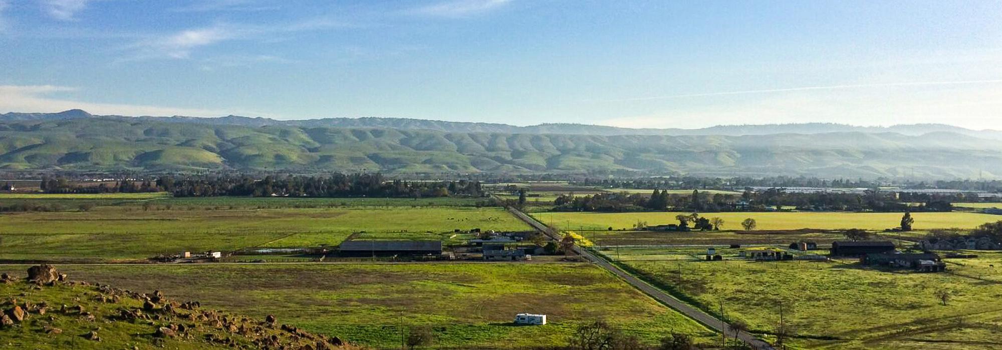
Environmental groups and local stakeholders fear that focusing solely on the issue of economic development rather than flood mitigation and sustainability will see the City revert to previous policy positions. The city’s general plan has long considered the 1,400-acre North Coyote Valley ideal for industrial development, while the 2,000-acre Mid-Valley (from just south of Bailey Avenue to Palm Avenue) was designated an urban reserve, and the 3,600-acre South Coyote Valley (from Palm Avenue to Morgan Hill) is a protected greenbelt. In the wake of the 2017 storms, both Anderson Dam and Coyote Creek overflowed, causing the evacuation of 14,000 people and $100 million in property damage. With the onslaught of increasing extreme-weather events, the floodplains provide a critical line of defense for the city.

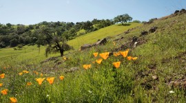
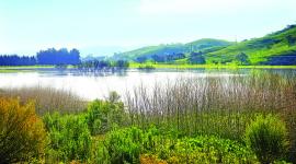
Forming the southern edge of the city, the Coyote Valley comprises wetlands, wildflower meadows, ranches, and working farmlands, providing some 2,500 acres of floodplain that are also crucial to Silicon Valley’s groundwater aquifer. Linking the Santa Cruz Mountains in the west and the Diablo Range to the east, the valley is also an essential wildlife corridor for mountain lions, bobcats, American badgers, gray fox, coyotes, the western burrowing owl, and other fauna, some of which are critically endangered.
TCLF included Coyote Valley in its Landslide 2017: Open Season on Open Space, in response to a report by the Greenbelt Alliance, a San Francisco-based advocacy group founded in 1958, which noted that about half of the valley could soon be developed.