San Jose City Council Mulls Action on Coyote Valley
On Tuesday, January 22, 2019, the San Jose City Council will consider the public purchase of lands in Coyote Valley at a special study session. The council will therefore have an opportunity to protect a significant cultural landscape in perpetuity. The Greenbelt Alliance and other advocacy groups will host a rally outside City Hall today, aimed at urging the City Council to purchase land in the valley’s northern section. In the November 2018 election, voters passed ‘Measure T’, an infrastructure bond that approved up to $50 million to protect green infrastructure in the 7,400-acre Coyote Valley. The money can be used to invest in resiliency measures, public safety, and land acquisition for flood and water quality protection. One of the last significant pieces of open space in Northern California’s San Francisco Bay Area, Coyote Valley has been continually threatened by urban sprawl since the 1980s when it was first designated for industrial development. The recently approved bond measure would potentially reverse the city’s decades-old industrial policy, allowing it to embrace sustainability.

Urban and industrial sprawl has been the major concern in Coyote Valley for decades. According to the Greenbelt alliance, a San Francisco-based advocacy group founded in 1958, more than half the valley is at risk of being developed. The city’s general plan has long considered the 1,400-acre North Coyote Valley (from Tulare Hill to just south of Bailey Avenue) ideal for industrial development, while the 2,000-acre Mid-Valley (from just south of Bailey Avenue to Palm Avenue) was designated an urban reserve and the 3,600-acre South Coyote Valley (from Palm Avenue to Morgan Hill) is protected greenbelt.
In 1999 the North Coyote Valley narrowly escaped being converted into the massive Coyote Valley Research Park, and in 2007 the Dahlin Group floated a master plan for a new town between San Jose and the bordering city of Morgan Hill. Facing unprecedented public criticism from myriad organizations and individuals and 28 public agencies, the plan has since been terminated. San Jose is the only city in Santa Clara County that allows developers to select the environmental consultants who evaluate the impacts of their proposed projects. Proactive environmental groups have, however, managed to protect the valley, purchasing large parcels of land in the area to prevent the critical wildlife corridor from being lost.

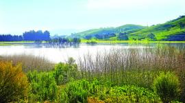
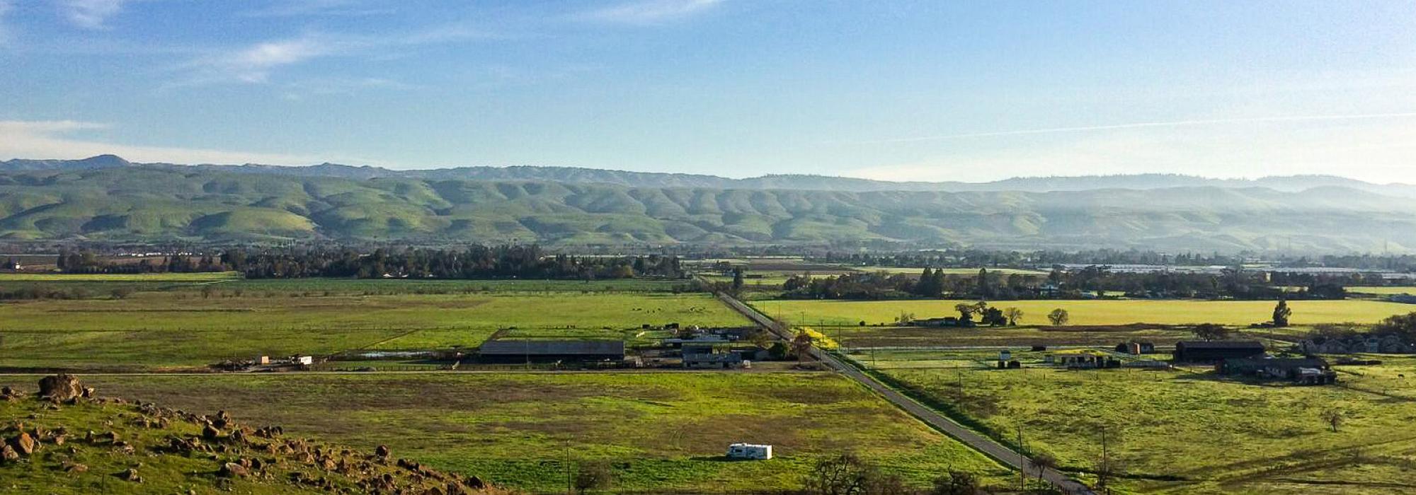
Historically characterized by five major habitat types and containing Laguna Seca (one of the largest wetlands in the Bay Area), the valley was part of the ancestral lands of the Amah Mutsun and Muwekma Ohlone people until Spanish colonization in the 1700s. Now forming the southern edge of the city, just below Silicon Valley, and comprising wetlands, wildflower meadows, ranches, and working farmlands, Coyote Valley provides some 2,500 acres of floodplain that mitigates flooding and is crucial to Silicon Valley’s groundwater aquifer. Linking the Santa Cruz Mountains in the west and the Diablo Range to the east, the valley is also an essential wildlife corridor for mountain lions, bobcats, American badgers, gray fox, coyotes, the western burrowing owl, and other fauna, some of which are critically endangered.
In the wake of the 2017 storms, both Anderson Dam and Coyote Creek overflowed, causing the evacuation of 14,000 people and $100 million in property damage. With the onslaught of extreme weather due to climate change, the floodplains provide a critical line of defense for the city. TCLF added Coyote Valley to its Landslide program in 2017, including the landscape as one of a handful of sites featured in its Landslide 2017: Open Season on Open Space.