San Jose City Council Spurred to Act on Coyote Valley
On June 11, 2019, the San Jose City Council will undertake its customary four-year assessment of the Envision San Jose 2040 General Plan. The general plan sets the tone for official policy on the future character of development in the City of San Jose, California. It also defines the amount, type, and stages of development required to meet environmental, social, and economic targets. The review will provide an opportunity for the council to evaluate the city’s achievements with respect to key planning goals and recommend course adjustments in sectors that have fallen short. The meeting is part of a process involving months of discussion and public comment, where the council will refine its list of policy priorities. In the face of a growing climate crisis, environmental stewards believe the meeting must reconsider the city’s vision for the 7,400-acre Coyote Valley. One of the last, large-scale, open spaces in Northern California’s San Francisco Bay Area, the valley has been continually threatened by urban sprawl since the 1980s, when it was first designated for industrial development by the city.
Although the previous iteration of the Envision San Jose 2040 General Plan, adopted in 2011, indicated that the industrial development of the valley could generate some 35,000 jobs, currently the plan to conserve the valley has an overwhelming democratic mandate. In November 2018, voters passed ‘Measure T’, an infrastructure bond that approved up to $50 million to protect green infrastructure in Coyote Valley. The money can be used to invest in resiliency measures, public safety, and land acquisition for flood and water-quality protection. Nevertheless, the city council hesitated to follow through and publicly purchase the valley lands. With a mere 8,000 acres of industrial land left in San Jose, several council members believe that North Coyote Valley (from Tulare Hill to just south of Bailey Avenue) could provide industrial work opportunities to those without college degrees.

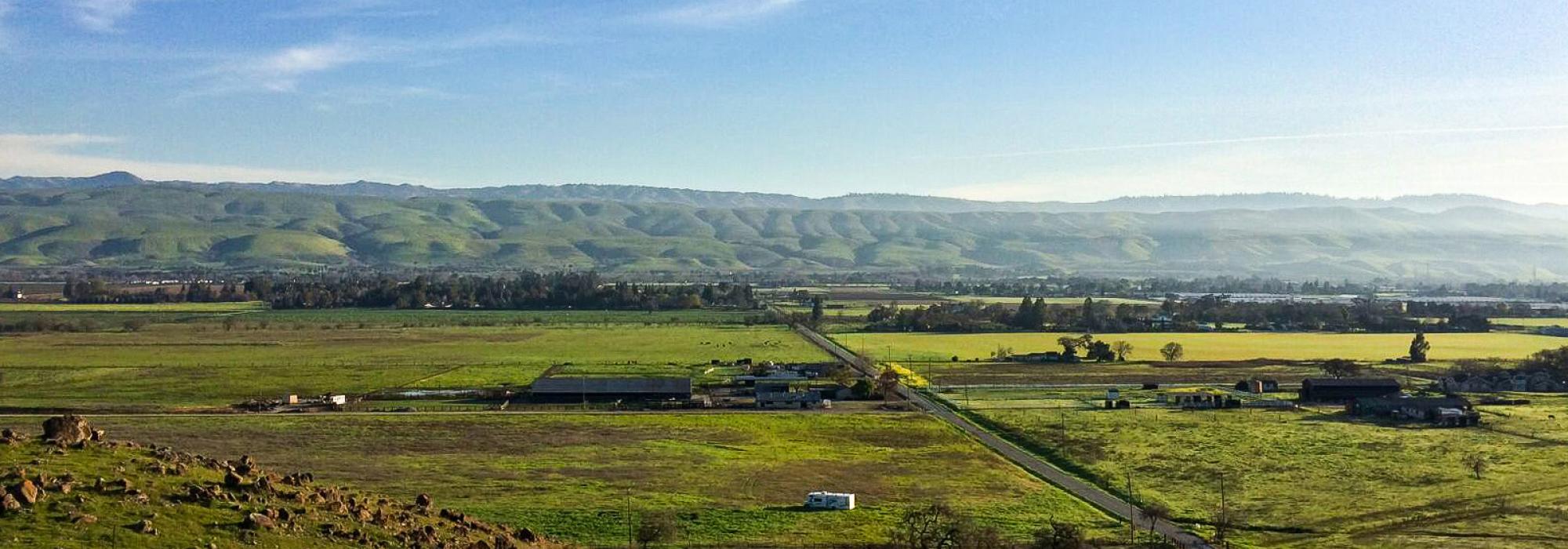
As the largest undeveloped landscape overlaying Silicon Valley’s groundwater aquifer, Coyote Valley provides 2,500 acres of floodplain to mitigate flooding and is critical to the city’s water supply. And notably, San Jose has been continually plagued by a shortage of water and chronic flooding. Until recently, the city underwent a prolonged period of drought that required almost a million residents to reduce their water consumption drastically. And as a coastal city, San Jose remains vulnerable to the growing threat of rising sea levels. This is evinced in the 2017 floods, the worst in a century, when the overflowing Anderson Dam swelled the local Coyote Creek and trapped hundreds of residents in their houses, forcing approximately 14,000 citizens to evacuate. This cycle of alternating flooding and droughts has also resulted in saltwater intrusion, threatening the city’s drinking water supply.
In early April 2019, a bill (CA AB948) was introduced by California State Representative Ash Kalra (D-California) to create a Coyote Valley Conservation Program under the Santa Clara Valley Open Space Authority. The Authority, which currently manages protected parts of the valley, would be notified of any plans for projects in the area and would be entitled to provide an analysis of environmental impacts. This is critical, as San Jose is the only city in Santa Clara County that allows developers to select the environmental consultants who evaluate the impacts of their proposed projects. The legislation is yet to be ratified.

Meanwhile, the threat of sprawl, which has been a concern in the area for several decades, has grown more acute. In 1999 the North Coyote Valley narrowly escaped being converted into the massive Coyote Valley Research Park, and in 2007 the Dahlin Group floated a primary plan for a new town between San Jose and the bordering city of Morgan Hill. Facing unprecedented public criticism from myriad organizations, individuals, and 28 public agencies, the plan has since been terminated. Proactive environmental groups have, however, managed to protect the valley, purchasing large parcels of land in the area to prevent the critical wildlife corridor from being lost.
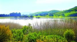
TCLF included Coyote Valley in its Landslide 2017: Open Season on Open Space in response to a report by the Greenbelt Alliance, a San Francisco-based advocacy group founded in 1958, which noted that about half of the valley could soon be developed. Forming the southern edge of the city, the valley comprises wetlands, wildflower meadows, ranches, and working farmlands, linking the Santa Cruz Mountains in the west and the Diablo Range in the east. This wildlife corridor is essential for mountain lions, bobcats, American badgers, gray fox, coyotes, the western burrowing owl, and other fauna, some of which are critically endangered.
In response to the city council meeting, Committee for Green Foothills, an advocacy group, has asked the public to join them at a rally outside City Hall on June 11, 2019. Interested parties can also e-mail the council, urging its members to revisit the plan’s vision for the valley.