Pioneer Information
Born in Scotland, Ralston immigrated to the United States following the Revolutionary War. A trained engineer, he served as personal assistant to Pierre Charles L'Enfant in 1791 during his planning for Washington, DC. Although L’Enfant was relieved of his duties in 1792, records indicate that Ralston continued to serve as a member of the capital’s engineering and surveying staff until 1797. At the turn of the century Ralston moved to the Ohio River Valley, living in Louisville, Kentucky and then Salem, Indiana before settling in Indianapolis.
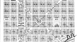
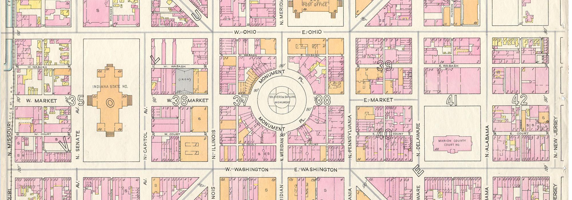
In 1820 Ralston was hired to survey land for the capital of the new state of Indiana on a four-square mile plat of dense forest near the confluence of the White River and Fall Creek. Inspired by his work with L’Enfant, he designed a Mile Square plan consisting of a central circle with four radiating avenues bisecting a grid of streets. The circle was allocated for the Governor’s House, while other plots were designated as the State House, Court House, two markets and three religious institutions. In similar fashion to the nation’s capital, significant streets were named after states, including the four radial arteries: Massachusetts, Virginia, Kentucky, and Indiana Avenues.
Ralston worked as a surveyor in Marion County until his death in 1827, though his Mile Square was not fully realized until 1850 when growth of the city demanded more formal planning. Ralston was buried in Greenlawn Cemetery on the eastern bank of the White River until it closed due to flooding in 1874, and his remains were moved to their final resting place at Crown Hill Cemetery.