Landscape Information
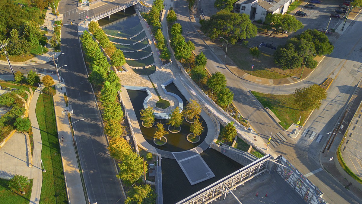
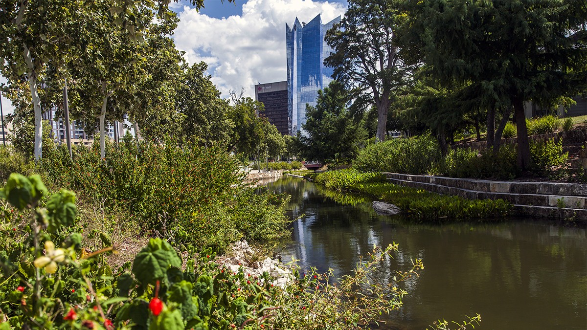
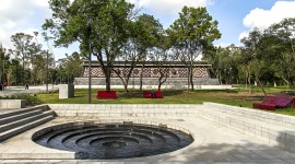
Previously a concrete-lined drainage ditch that serviced stormwater runoff in the city’s historic center, this linear park gently curves south from North Santa Rosa Street to the Apache Creek. The waterfront park’s design was undertaken by the San Antonio River Authority with landscape architect Mario Schjetnan and his firm, Grupo de Diseño Urbano, with Muñoz & Company (now Alta Architects), Rialto Studio landscape architects, and Ford, Powell & Carson architects and planners. Completed in phases between 2018 and 2025 the park mitigated flooding, improved water quality, created habitat, and improved pedestrian access.
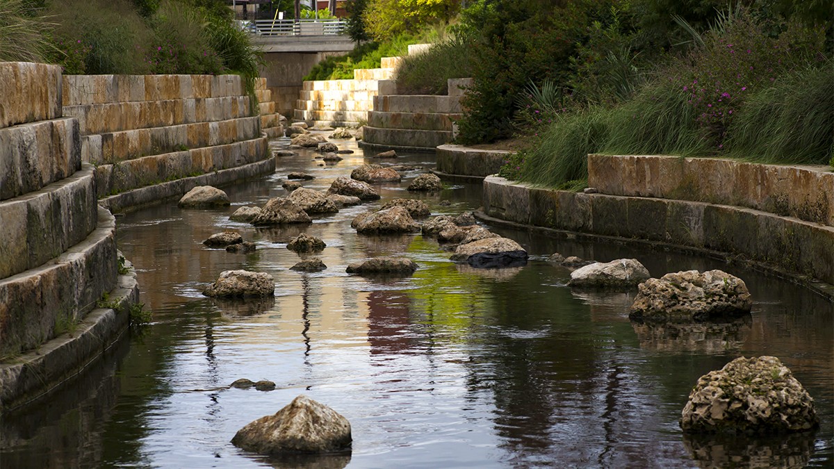
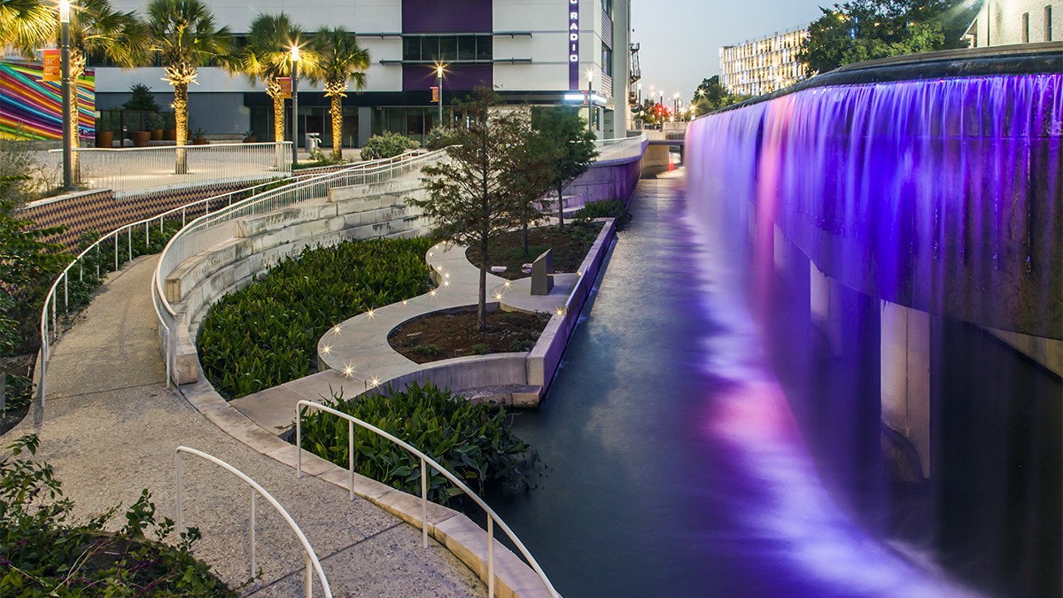
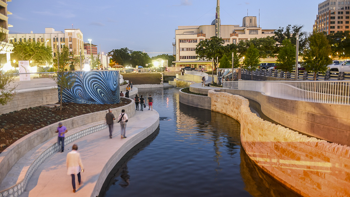
No longer a barrier between the city's west side and downtown, in the project’s first phase, the watercourse was lined with limestone and flanked by curvilinear walkways, tiled benches and local artists’ murals that capture the city’s history and historic figures. Riparian beds are planted with trees—including Montezuma cypresses, oaks and sycamores—flowering perennials, and grasses. Immediately south of the flood control inlet at Santa Rosa Street, the Plaza de Fundación symbolizes the birth of water, which flows southward to a sequence of various waterfalls, ponds, and irrigation ditches. From the plaza, water flows into a traditional Mexican irrigation (acequia) ditch that continues into the waterway navigable via arcing rows of stone slabs. Further south water cascades downward flowing both in the channel and over vertical surfaces.
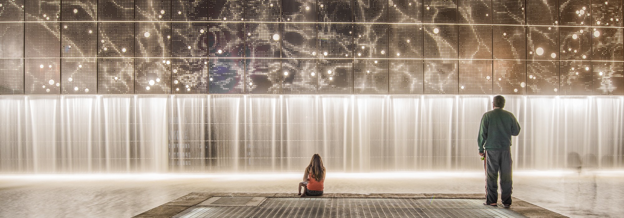
The park traverses more than two miles and includes rehabilitated historic walls and bridges, overlooks, public art, and interpretive landscape features that evoke and commemorate history. The latter includes the flood tunnel inlet’s stainless-steel wall, whose perforations replicate the night sky as it appeared on May 5, 1718, the founding date of Presidio San Antonio de Béxar.