Landscape Information
Intending to lend Calgary the same stature as other well-recognized cities in North America, the Canada Pacific Railway (CPR) began expanding west in the 1910s. John Charles Olmsted of Olmsted Brothers was hired to design three residential suburbs on CPR land in Calgary, including present day Scarboro (formerly Sunalta Addition). Laid out as a system of parks and boulevards, the landscape was built out in accordance with Olmsted’s plan and remains largely intact to this day. Scarboro is one of two complete Olmsted-designed neighborhoods in Canada, along with Uplands in Victoria, British Columbia.
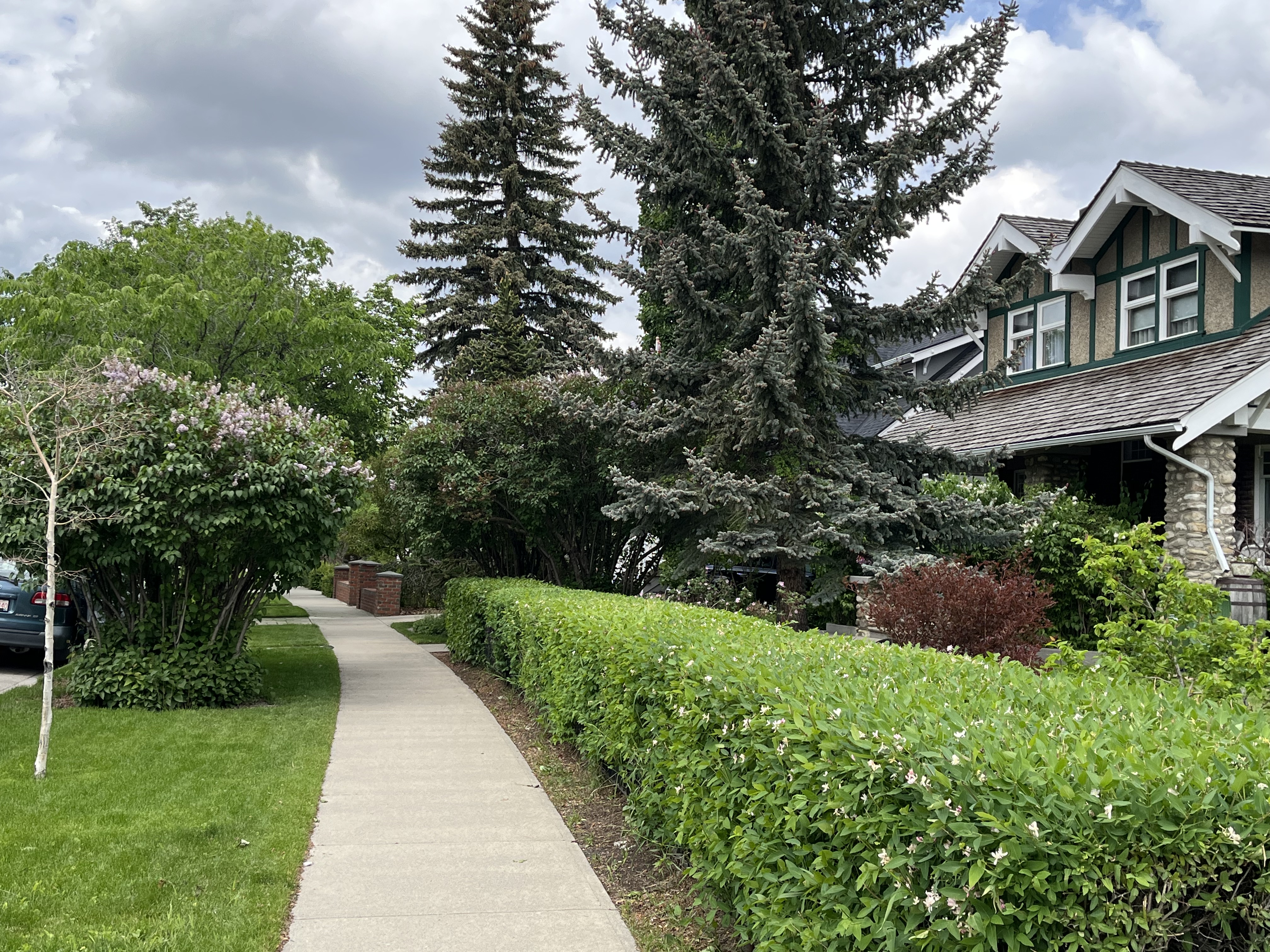
Perched on a natural escarpment above the Bow River, curvilinear boulevards, sidewalks, and pathways provide and connect green spaces throughout the 113-acre neighborhood which is Twenty-two percent green space. Small, triangular parklets at intersections of curving streets is a typical element found in residential districts designed by the Olmsted firm in the late 19th and early 20th centuries. Minimal grading modifications were implemented throughout the community, to maintain the natural undulating topography. Native vegetation cover was deemed valuable by Olmsted and was not removed along the bluff. Instead, he complemented existing shrubs and trees with numerous plantings of additional large street trees, hedges, and small perennial gardens with the ample tree canopies sheltering and enclosing the wide roads. Over the years, landscaping along the streets and boulevards, as well as the park areas, has continued. Original extant landscape features include Triangle Park, Scotland Street Triangle/Plot and Royal Sunalta Park.
The Scarboro landscape’s curvilinear streets and irregularly shaped lots follow the natural topography which resulted in several large and irregular shaped lots. While most urban areas in North America are characterized by a gridiron plan of 25 ft. lots, the Sunalta Addition boasted typically 50 ft. lots with many larger homes built on double lots, which allowed for large front and side setbacks and gardens. Housing development continued from 1912 through the 1930’s and was finally completed by 1960 which created an “architectural layering” of styles reflective of local and international trends.